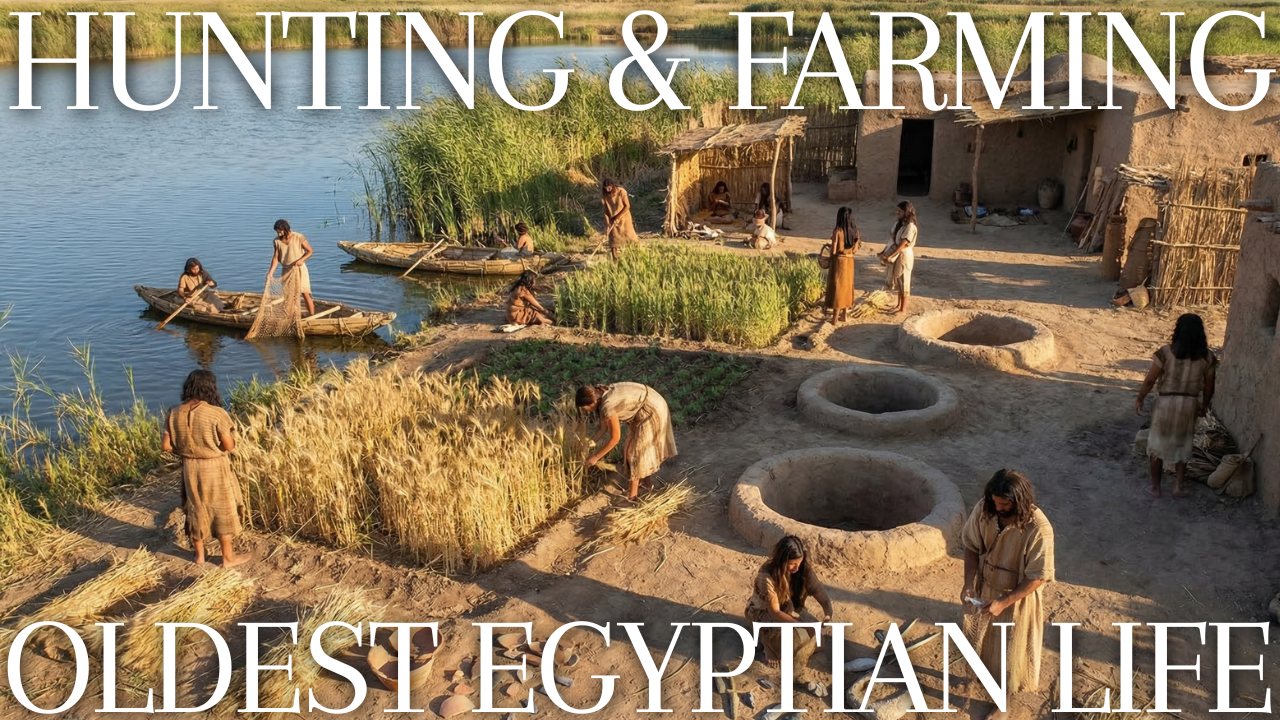
What Was the Fayum A Culture? A Short Answer First
The Fayum A culture is the name archaeologists give to a group of Neolithic communities that lived on the northern shore of a lake in the Fayum, a low-lying basin west of the Nile in Egypt. Their sites contain some of the oldest evidence for crops and livestock found anywhere in the country, alongside pottery, finely worked flint tools and storage pits that once held grain. That combination is why the Faiyum A culture so often appears in textbooks as the starting point of Egyptian farming.
Short definitions like that one hide almost everything interesting. Specialists still disagree about how these people lived, how much they relied on farming, and even whether the label itself points in a helpful direction. If you searched for “Fayum A” (or one of its many spellings, from Faiyum A to the run-together FayumA used in some catalogues), you have probably already noticed that different sources tell slightly different stories.
This post takes two steps toward a clearer picture. The first section looks at the name: where it came from, what it assumes and how it fits into the wider sequence of Egyptian prehistory. The second turns to climate, because no account of the faiyum a culture in Egypt makes sense without the drying of the Sahara that unfolded around it. Both sections are taken directly from a longer book-length study of the culture.
The complete edition on Kindle: explore the evidence and debates about the Fayum A culture
Liberal Arts Bundle: read this book with other English-language guides

Naming a Culture: What “Fayum A” Really Means
Archaeological names are rarely chosen with posterity in mind. They are labels attached in the field, often in a hurry, by people trying to keep two piles of material apart. The name “Fayum A” is one of these working labels, and it has survived for a century largely because nothing better has displaced it. Understanding where it came from, and what baggage it carries, is the first step to understanding the culture itself.
A Letter for a Sequence
When Gertrude Caton-Thompson and the geologist Elinor Wight Gardner surveyed the north shore of the Fayum depression between 1924 and 1928, they encountered two very different kinds of prehistoric debris. One group of sites contained pottery, polished stone axes, finely flaked arrowheads with hollowed bases, sickle blades and evidence of stored cereal grain. The other contained no pottery and was dominated by tiny stone blades and bladelets, the sort of toolkit associated with hunters and fishers. They called the first group “Fayum A” and the second “Fayum B.”
The lettering was intended to reflect what they then believed about the order of events. In their view, the B material belonged to a later, impoverished phase that followed the A culture as the lake shrank. Later fieldwork reversed this. Radiocarbon dates and careful stratigraphic work by Polish and American teams showed that the pottery-free, microlithic material was older, belonging to the seventh and early sixth millennia BC, while the pottery-bearing material belonged to the later sixth and fifth millennia. In other words, the letters ended up in the wrong order. Fayum B came first.
This reversal explains a confusion that still trips up readers today. A label that sounds like “phase one” actually refers to the second of the two major prehistoric cultures in the basin. Specialists solved the problem partly by renaming the older material. The Fayum B assemblages are now usually called the Qarunian, after Lake Qarun, the shrunken salt lake that survives in the depression today. The Fayum A material, meanwhile, increasingly goes by the descriptive term “Fayum Neolithic,” or sometimes “Fayumian.”
Spellings and Search Terms
The place name itself has several accepted spellings in English, and each turns up in the literature. “Fayum” is the most common in archaeological writing. “Faiyum” follows a transliteration closer to the Arabic and is widely used in museum catalogues and by Egyptologists working on pharaonic and Roman material. “Fayoum” appears on Egyptian government signage and in the name of the modern governorate, and “Fayyum” is favoured by some American projects, including the team that worked in the basin in the 1980s. The culture name therefore appears as Fayum A, Faiyum A, Fayoum A and occasionally as a single compressed word in online databases.
None of these spellings is wrong. They point to the same assemblage, the same sites and the same period. When you search catalogues or journal databases, though, it pays to try all of them, because a museum may file its Neolithic flints under “Faiyum” while a geoarchaeology paper on the same shoreline uses “Fayum.”
What Counts as a “Culture”
The word “culture” in archaeology has a narrower meaning than in everyday speech. It refers to a recurring set of material traits found together at multiple sites in a defined area and period. For the Fayum A culture, the classic diagnostic set includes several elements that co-occur on the north shore:
- handmade, mostly undecorated pottery, some of it burnished red or black
- bifacially flaked arrowheads with concave bases
- serrated flint sickle blades used for harvesting cereals
- polished and flaked axes
- basket-lined storage pits containing wheat and barley
- bones of domestic sheep, goats, cattle and pigs alongside very large quantities of fish
An archaeological culture is a classification device, not a people with a known name, language or identity. Nobody living beside the lake around 5000 BC called themselves “Fayum A.” We do not know what language they spoke, how they reckoned kinship, or whether they saw themselves as one community or many. The label groups objects, and any statement about people built on top of it is an inference.
That caution matters especially in the Fayum, where the material traits do not all appear together everywhere. Some north-shore localities contain pottery but few formal tools; others contain hearths and fish bone but no evidence of domestic animals. One recent survey of a surface deposit known as XB11 found that of about 3,500 identified stone artefacts, only ten were “formal” tools such as axes, sickle blades or concave-based arrowheads. Most of the archaeological record consists of the ordinary debris of flaking stone, cooking fish and lighting fires. The diagnostic items that define the culture are, statistically, rare.
“Neolithic” and Its Assumptions
The term “Neolithic” carries more freight than “culture.” In its original nineteenth-century sense, it meant the “New Stone Age,” defined by polished stone tools. Over the twentieth century it came to stand for a whole package of changes: farming, herding, pottery, permanent villages, and often new forms of social organization and belief. When Caton-Thompson described the Fayum A people as Neolithic, she was drawing on that package model, which had been built largely from the evidence of Southwest Asia and Europe.
Calling the Fayum culture Neolithic implies that its members lived like early farmers in the Levant or Anatolia: in houses, in villages, growing crops in permanent fields. The Fayum evidence fits that picture only partly. Domesticated plants and animals are present, but fish dominate the animal bones. Pottery and granaries are present, but convincing house remains are absent. The basket-lined grain pits are spectacular, but they can be read as evidence of a population that left and returned rather than one that never left. Some researchers therefore put the word in quotation marks, as in the title of a major faunal study from the Fayum that speaks of the Fayum “Neolithic.”
The disagreement is not merely about vocabulary. If the Fayum A people were sedentary farmers, their story is one of rapid adoption and transformation. If they were mobile fishers and foragers who used domesticates as one resource among many, their story is one of selective borrowing and continuity.
Where the Label Sits in the Larger Egyptian Sequence
Egyptian prehistory is conventionally divided into a series of named phases that culminate in the unification of the country around the end of the fourth millennium BC. In Upper Egypt, the long Nile valley to the south, the sequence runs from the Badarian through the Naqada phases. In Lower Egypt, the Delta and the region around modern Cairo, archaeologists recognize Merimde Beni Salama, el-Omari and later Buto-Maadi. The Fayum sits geographically between these two worlds, about a day’s walk west of the Nile valley south of Cairo.
In this scheme the Fayum Neolithic is usually placed at the very start of the Lower Egyptian sequence. It overlaps with the early phases of Merimde and precedes the Badarian of Middle Egypt. The Fayum is often listed in textbooks as the oldest of the farming cultures of Egypt, a claim that rests on the dates of the earliest domestic animal bones and cereal finds there. A recent synthesis of Fayum faunal data places the first appearance of domesticated plants and animals in the basin at approximately 5400 BC.
| Term | Alternative names | Approximate date range | Defining features |
|---|---|---|---|
| Qarunian | Fayum B, Fayum Epipalaeolithic | c. 7100 to 6000 cal BC | Microlithic stone tools, fishing and hunting, no pottery or domesticates |
| Fayum Neolithic | Fayum A, Faiyum A, Fayumian | c. 5700 to 4200 cal BC (main dated occupation around 4650 to 4350 BC) | Pottery, bifacial arrowheads, sickle blades, basket-lined granaries, domestic plants and animals alongside heavy fishing |
Between these two phases lies a stretch of time that the radiocarbon record covers only thinly, roughly the last centuries of the seventh millennium and the first part of the sixth. Whether that interval reflects a real abandonment of the north shore, a change in where people camped, or simply the destruction of sites by wind and later farming is one of the open questions of Fayum archaeology. The core contrast in modern work is therefore between the Qarunian and the Fayum Neolithic, and between continuity and change across the boundary that separates them.
Labels Across Languages
Fayum research has never been an English-language monopoly. Polish archaeologists from the Jagiellonian University in Kraków, working with the Combined Prehistoric Expedition, published key definitions of the Qarunian. American teams surveyed the northeastern and southwestern parts of the basin. German scholars set the Fayum beside their own excavations at Merimde Beni Salama in the western Delta. Dutch institutions co-led the most recent large field project, and one of the most prolific recent analysts of Fayum stone tools, Noriyuki Shirai, trained at Leiden University and publishes from a Japanese perspective on Neolithic origins. Each tradition brought its own habits of naming. German writers speak of the “Fayum-Neolithikum,” French writers of the “Néolithique du Fayoum,” and Japanese writers use a transliteration of the Arabic place name followed by the letter A.
These differences are more than cosmetic. Each research tradition tends to frame the Fayum through its own reference cases. Scholars who know the Levantine Neolithic well tend to read Fayum sickle blades and arrowheads as signs of a migrating farming population. Scholars steeped in African pastoral archaeology tend to stress continuity with older Saharan and Nilotic lifeways. Reading across languages is one way to see how much of any interpretation comes from the evidence and how much from the comparative lens the interpreter brings.
Why the Name Still Matters
One might ask why specialists keep using a label whose letters point in the wrong direction and whose central word, Neolithic, is contested. Part of the answer is inertia. Museum collections catalogued in the 1920s and 1930s, from London to Amsterdam to Cairo, file their Fayum material under the original terms. Anyone who wants to restudy those collections, as several researchers have done in recent years, has to work within the old categories before revising them.
Another part of the answer is that the label still marks something real. Whatever their degree of mobility or settlement, the people who left behind concave-based arrowheads, sickle blades and basket-lined granaries on the north shore of the Fayum did something new in Egypt. They combined imported domesticates with a deeply local way of life built around a lake. The label “Fayum A” is a shorthand for that combination.
The danger lies only in letting the shorthand stand in for argument. A label invites us to imagine a uniform group, sharing one way of life, across a whole basin and over many centuries. The evidence from the Fayum suggests something messier: overlapping visits, shifting shorelines, varied tool use and a record that wind erosion has scrambled.
A Note on Dates and Their Notation
Readers moving between sources will find dates written in several ways, and the differences are not trivial. “BC” and “BCE” mean the same thing; the latter is simply the religion-neutral form preferred by many scholars. More significant is the distinction between calibrated and uncalibrated radiocarbon dates. A date written as “cal BC” has been corrected using tree-ring and other records to convert a laboratory measurement into calendar years. An older publication may give an uncalibrated date in “BP” (years before present, with “present” fixed at AD 1950) that, once calibrated, shifts by several centuries.
Many early accounts of the Fayum A culture used uncalibrated dates, which made the culture look younger than it was. Britannica’s account of Caton-Thompson’s work, for instance, reports that she distinguished an older culture dating to about 5000 BC and a younger one to about 4500 BC. Those figures reflect the understanding of her time, including her order of A and B, rather than the calibrated, re-sequenced chronology now in use. When a source gives a date for the Fayum, it is worth checking whether it is calibrated and which phase it actually refers to.
Climate and the Faiyum A Culture in Egypt
A name tells you how archaeologists sort the evidence. It does not tell you why people were living beside a desert lake in the first place, or what pressures shaped their choices. For that, the lens has to widen from a single basin to the whole of northeastern Africa, and from a few centuries to several thousand years.
The section below follows that wider view. It traces how a shift in rainfall turned parts of today’s Sahara into grassland and then back into desert, and why a lake connected to the Nile became such a valuable place to be as that change played out.
A Greener Sahara and Its Ending
Stand today on the escarpment above the Fayum and look west, and you see one of the driest places on Earth. Rain may not fall for years at a time. Yet the desert is littered with evidence that it was not always so: ancient lake beds, fossil river channels, grinding stones, hearths and rock art depicting animals that could never survive there now. The Fayum A culture took shape during the closing chapter of that greener age, and its story cannot be separated from the climate that was slipping away beneath it.
The Engine of the Monsoon
North Africa’s climate is governed by the African monsoon, the seasonal belt of rain that moves north in summer as the land heats up and draws in moist air from the oceans. Today that belt reaches the Sahel, the semi-arid strip along the southern edge of the Sahara, but stops well short of Egypt. Over thousands of years, however, the reach of the monsoon has changed dramatically, and the main driver of that change lies in the sky.
The Earth’s orbit and the tilt of its axis wobble in regular cycles. One consequence is that the amount of sunlight reaching the Northern Hemisphere in summer rises and falls over periods of roughly twenty thousand years. During the early Holocene, the geological epoch that began about 11,700 years ago, Northern Hemisphere summers received noticeably more solar energy than they do now. Hotter summer land surfaces pulled the monsoon belt farther north. Rain fell across areas of the Sahara that are now bare sand and rock.
Feedbacks amplified the effect. As rain fell, grass and shrubs spread, darkening the land surface so that it absorbed more heat and released more moisture, which in turn encouraged more rain. Lakes formed in desert basins and fed local cloud formation. Palaeoclimatologists call this interval the African Humid Period. In the eastern Sahara, the zone that includes Egypt’s Western Desert, it transformed a landscape that had been uninhabitable during the last ice age into a patchwork of savanna, seasonal lakes and grassland.
People Follow the Rain
The most influential reconstruction of how people responded to this shift comes from Rudolph Kuper and Stefan Kröpelin of the University of Cologne. In a paper published in the journal Science in 2006, they assembled radiocarbon dates from 150 archaeological excavations across the eastern Sahara, in Egypt, Sudan, Libya and Chad, and used the distribution of those dates in space and time as a proxy for human presence.
Their results traced a clear rhythm. During the last glacial maximum and the very end of the Pleistocene, the desert was empty of settlement outside the Nile valley, and its southern edge lay some 400 kilometres farther south than it does today. Once humid conditions arrived, around 8500 BC, people moved out of the valley and into the newly habitable lands. They camped beside seasonal lakes, hunted, gathered wild plants and, in time, herded cattle and other livestock.
From around 5300 BC, according to the same analysis, the eastern Sahara began a gradual drying. Rainfall retreated southward, lakes contracted and the human population followed the rain, withdrawing to the south or concentrating in places where permanent water remained. Kuper and Kröpelin argued that this retreat helped set the stage for the rise of pharaonic civilization along the Nile, as people and practices from the desert converged on the river valley, and that it also influenced the spread of pastoralism across the African continent.
Abrupt or Gradual?
Specialists still debate how quickly the African Humid Period ended. Marine sediment cores off the coast of northwest Africa, studied by Peter deMenocal and colleagues around the turn of the millennium, recorded a sharp increase in wind-blown dust at the end of the humid interval, which they interpreted as an abrupt termination taking place over a few centuries. Other records, especially from lakes and from archaeological sites within the desert itself, suggest a more staggered, region-by-region drying.
Kuper and Kröpelin explicitly challenged the assumption that the Holocene was climatically stable, arguing that records from polar ice and ocean sediments cannot simply be transferred to the subtropical lands where people actually lived. Their position is that the desert’s own geological and archaeological evidence must be read on its own terms. For the Fayum, this matters: the timing of drying in the Western Desert, the strength of Ethiopian rains feeding the Nile, and the level of the Fayum lake need not have changed in lockstep.
The picture that emerges is of a long, uneven transition rather than a single switch. Some areas dried earlier than others; some lakes survived as refuges for centuries after the surrounding plains turned to desert. Short wet and dry episodes were superimposed on the longer trend. People living through it would have experienced not a smooth decline but a series of bad years and good years, droughts and recoveries, with the bad years gradually becoming more frequent.
The Fayum as a Refuge
In this context, the Fayum lake had a special advantage over the desert lakes farther west. Most Saharan lakes depended entirely on local rainfall. When the monsoon retreated, they dried. The Fayum lake depended instead on the Nile, and the Nile drew its water from the Ethiopian highlands and the equatorial plateau, regions where the monsoon persisted long after it had abandoned the Sahara. As long as the Nile flood remained strong enough to spill into the depression, the Fayum would keep a permanent body of fresh water even as the surrounding desert dried.
This made the basin a natural refuge. For hunters and herders retreating from drying desert pastures, and for fishers already established on its shores, the lake offered food in every season. Noriyuki Shirai, whose doctoral research at Leiden University examined the Fayum Epipalaeolithic and Neolithic, has argued that the introduction of farming to the Fayum should be understood partly in these terms. In his reading, as the climate dried and people gathered around permanent sources of water during the sixth millennium BC, the resulting imbalance between population and wild resources created conditions in which cultivated crops and domestic animals became attractive additions to the food supply.
Other explanations are possible, and Shirai himself presents it as one factor among several. But it captures an important point. Farming in the Fayum did not arrive in a land of plenty where people had nothing better to do. It arrived during a time of environmental stress, in a place where people may have been crowding in from the surrounding desert.
Climate and the River
The Nile itself was not immune to change. Its summer flood depended on the strength of rain over the Ethiopian highlands, which in turn responded to the same orbital forces that governed the Saharan monsoon, though with different timing and intensity. During the early Holocene, flood levels in the Nile valley were generally high. As the monsoon weakened through the middle Holocene, average flood heights declined, though not smoothly.
For the Fayum, a weaker flood had a magnified effect. The gap at Hawara and el-Lahun allowed water into the depression only when the Nile rose above a certain height. A modest decline in average flood levels could cut the inflow sharply, because more years would fall below that threshold altogether. A lake that had been fed every year might now receive water only in good years, and fall steadily in between. The shallow margins would retreat by hundreds of metres or more, and the basin’s salt balance would begin to shift.
This threshold effect may explain why the archaeological record of the Fayum seems to show distinct episodes of occupation rather than continuous habitation. When the lake was high and fresh, its shores attracted people. When inflow failed for a run of years, the shoreline moved away from established camps, and the people who used them may have shifted elsewhere around the basin or left it entirely.
Living with Uncertainty
One consequence of a fluctuating climate is that strategies optimized for a single set of conditions become dangerous. A community that depended entirely on crops planted on the lake margin would starve in a year when the lake failed to retreat at the right time, or retreated too far. A community that depended entirely on fishing would suffer if the lake shrank into a salty, oxygen-poor pond. A community that herded animals would face hunger if the grazing on the margins died back.
Anthropologists who study farming and foraging peoples in unpredictable environments have documented a range of responses to this kind of risk. Some spread their effort across several food sources so that a failure in one is cushioned by the others. Some move between locations to take advantage of shifting resources. Some store food in good years against bad ones. Some build networks of exchange and obligation with neighbours, so that a group in difficulty can call on others for help.
The Fayum A record shows evidence of at least the first three of these responses. The mixed diet of fish, wild game, domestic animals and cereals is a classic risk-spreading strategy. And the basket-lined granaries are, above all, a technology of storage.
A Wider Perspective on Climate and Culture
It is easy to overstate the role of climate in prehistory. Environmental determinism, the idea that climate dictates how societies develop, has a long and sometimes troubling history in archaeology, not least because it was once used to explain away the achievements of African societies. Modern researchers are careful to treat climate as a set of opportunities and pressures rather than a script.
In the Fayum, climate set the stage, but people made choices within it. Some of those choices look conservative: continuing to fish intensively long after domestic animals were available. Others look innovative: adopting a storage technology on a scale unknown in Egypt before. The same drying climate that drove some Saharan groups toward the Nile valley drove others south toward the Sahel. The Fayum A culture represents one particular set of choices, made by particular people in a particular basin, and its interest lies precisely in how those choices differ from the classic model of agricultural transition.
Comparisons with the Levant help to sharpen this point. In Southwest Asia, the domestication of wheat, barley, sheep and goats took place over thousands of years during the early Holocene, under conditions that were broadly favourable and relatively stable. By the time those domesticates reached Egypt, they represented a mature, tested package. The Fayum A people encountered that package in a very different setting: a fluctuating lake in a drying desert. It should not surprise us that they used it differently.
The Climate Signal in the Fayum Record
Can the archaeological record of the Fayum itself be used to read climate? Indirectly, yes. The species of fish found at Neolithic sites, the kinds of wood burned in hearths, the location of sites relative to ancient shorelines and the gaps in the radiocarbon record all carry environmental information.
None of these indicators is a perfect climate thermometer. Each reflects human choices as well as environmental conditions. But taken together, and set against independent records such as Kuper and Kröpelin’s compilation and the long sediment cores now being drilled in the basin, they allow researchers to build a picture of the world the Fayum A people inhabited. That picture is of a basin that remained a refuge as the Sahara dried, but a refuge whose boundaries were constantly shifting.
The most direct link between climate and daily life in the Fayum was the shoreline itself. Where the water stood determined where people camped, where they fished, where they could plant and how far they had to walk to reach their granaries.
Why the Fayum A Story Still Matters
Prehistory is built from fragments: a handful of excavated mounds, scattered flints, heaps of animal bone and the shifting chemistry of old lake beds. Every name and every date attached to those fragments is a working hypothesis, open to revision when new fieldwork or new laboratory methods arrive. The Fayum is a particularly good place to watch that process in action, because its evidence has been studied, reinterpreted and argued over for roughly a hundred years.
If you want to keep exploring on your own, two habits will serve you well. Look for the date of any account you read, since interpretations of this region have moved quickly in recent decades. And when a source makes a sweeping claim about “the first farmers,” ask what kind of evidence lies behind it: grain, bones, tools, houses or simply an inherited label.
What you have just read is an excerpt from a much longer work. The full version follows the evidence well beyond the name and the climate, into chapters such as “The Granaries of Upper and Lower K,” “Sheep, Goats, Cattle and Pigs: The Herds of the Fayum,” and “Village or Tethered Camps? The Kom W Debate.” It also traces how a century of fieldwork, from the first surveys of the 1920s to recent landscape studies, has reshaped what we think we know. If the questions raised here caught your interest, the full version is where they are pursued in depth.
The full version, The Fayum A Culture, is available on Kindle for $4.60. Continue with the complete study, or explore this book alongside other English-language guides in the Liberal Arts Bundle.
The complete edition on Kindle: explore the evidence and debates about the Fayum A culture
Liberal Arts Bundle: read this book with other English-language guides
A Guide to Exploring Egypt Before the Pharaohs
Compare early farming communities
- El Omari Culture: Egypt’s Neolithic Village at Wadi Hof Explained — Compare the Fayum evidence with a farming village near the Nile Delta, including its setting, crops and daily life.

コメント