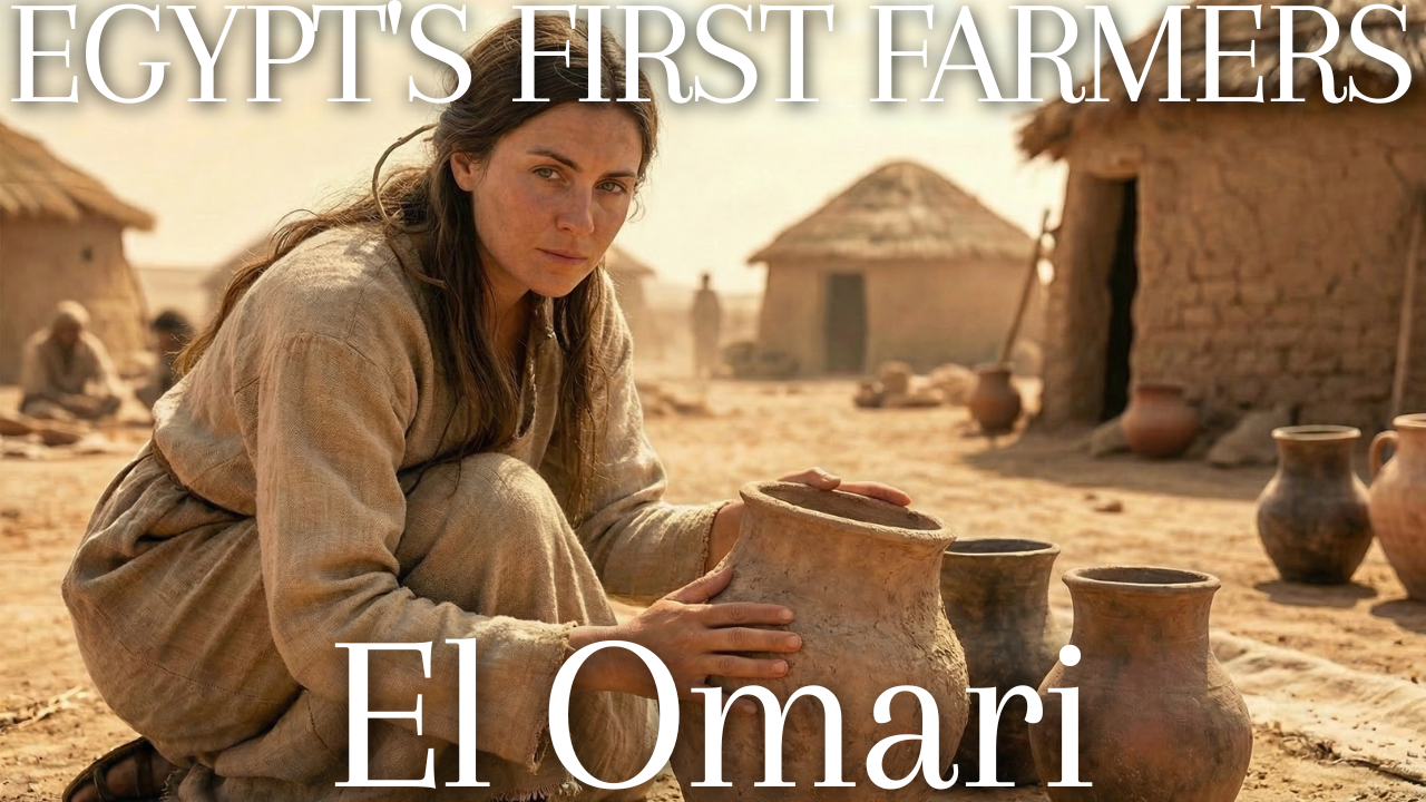
Most people meet ancient Egypt through its pyramids, gold masks and painted tombs. Far fewer have heard of the farmers who lived near modern Cairo some fifteen centuries before the first pharaoh, yet their village is one of the best windows onto how the north of Egypt began. That village gave its name to the El Omari culture.
What follows is an extended excerpt from a much longer study of the site. It explains what archaeologists mean when they speak of the El Omari culture, where and when it existed, why a settlement that left only pits matters, and why its people chose to live where they did. Read it as a guided first visit before going deeper.
The complete edition on Kindle: everyday life and the evidence from El Omari

Liberal Arts Bundle: read this book alongside other English-language guides to ancient civilizations

- What Was the El Omari Culture? A Neolithic Village in Lower Egypt
- Why the El Omari Culture Matters for Understanding Early Egypt
- Wadi Hof: Where the El Omari Culture Chose to Settle
- Reading the El Omari Landscape: Sediments, Neighbours and Lost Ground
- What the El Omari Culture Teaches Us About Egypt’s Beginnings
- A Guide to Reading Early Civilizations
What Was the El Omari Culture? A Neolithic Village in Lower Egypt
Egypt’s prehistory is often told as a story of the south. The famous painted pottery, the ivory combs, the decorated tombs of chiefs and the early royal cemeteries cluster in Upper Egypt, along the narrow valley between modern Luxor and Abydos. The north, the broad fan of the Nile Delta and the stretch of valley just south of it, has always been harder to read. Its sites lie under thick layers of river silt, under modern villages, or under the concrete of greater Cairo. The El Omari culture is one of the few windows into that northern world before the age of metal, and for that reason alone it occupies a larger place in scholarship than its physical remains might suggest.
What Archaeologists Mean by a Culture
The word culture in archaeology does not mean quite what it means in daily speech. When specialists speak of the El Omari culture, they are describing a recurring package of material traits found at one or more sites: a particular style of pottery, a characteristic set of stone tools, a recognizable way of building homes and burying the dead, all occurring together within a limited span of time and space. The label is a convenience for sorting evidence. It does not prove that the people who made these things spoke one language, felt themselves to be a single group or had a name for themselves that resembled anything we use.
That caution matters especially here, because the El Omari culture is defined largely by finds from one locality near Helwan. Excavators worked in two main areas, labeled Area A and Area B, and recorded related material at a nearby hill called Gebel Hof. A culture defined by a single cluster of sites is fragile. If future digging in the northern valley turns up similar material elsewhere, the boundaries of what counts as El Omari may shift. Some specialists already prefer to speak of a broader Lower Egyptian Neolithic in which El Omari is one local expression among several, and the debate over whether these northern groups formed one regional tradition or many local ones is still active.
Locating El Omari in Space
The site lies on the east bank of the Nile, about five kilometers north of Helwan, at the point where Wadi Hof, a dry desert valley draining the limestone plateau to the east, meets the edge of the floodplain. In modern terms this is the southern fringe of metropolitan Cairo. In prehistoric terms it was a borderland in three senses at once. It sat between desert and river, between the narrow valley of Upper Egypt and the spreading channels of the Delta a few dozen kilometers to the north, and between Africa and the land bridge of Sinai that leads to the Levant.
That threefold edge position is not incidental. The Delta apex, the point where the single stream of the Nile begins to divide, has been strategically important in every era of Egyptian history. The ancient capital of Memphis stood just across the river on the west bank, slightly to the south. Heliopolis, the great sun-cult center, stood to the north. Old Cairo grew where it did for many of the same reasons. People in the fifth millennium BC were responding to the same geography: a zone where routes along the river, routes across the desert and routes into the marshes all converged.
Upper and Lower: A Confusing Pair of Terms
Newcomers to Egyptian archaeology often stumble over the terms Upper Egypt and Lower Egypt, because on a modern map Upper Egypt sits at the bottom. The names follow the flow of the river, not the orientation of the page. The Nile runs from south to north, so the south is upstream, or upper, and the north, where the river reaches the Mediterranean, is downstream, or lower. Lower Egypt therefore means the Delta and the stretch of valley immediately south of it, roughly as far as the entrance to the Fayum. El Omari, near the Delta apex, belongs firmly to Lower Egypt.
The distinction is more than a matter of geography. The two regions offered different environments. Upper Egypt was a narrow ribbon of fertile land squeezed between cliffs, where farming communities lived close together and the desert edge was always in sight. Lower Egypt was a wide, wet landscape of channels, levees, swamps and seasonal lakes, rich in fish and waterfowl but harder to farm in a uniform way. Later Egyptians remembered the country as two lands, each with its own crown, its own patron goddess and its own symbolic plant. Whether that dual image reflects a real political division before unification is debated, but the material cultures of north and south were distinct for much of the fifth and fourth millennia BC, and El Omari is one of the clearest examples of the northern pattern.
That northern pattern can be summarized in a few contrasts. Southern pottery of the Predynastic period was often polished, decorated and produced in fine wares for burial. Northern pottery tended to be plain, utilitarian and made for daily use. Southern burials were placed in separate cemeteries, often with abundant grave goods. Northern Neolithic burials were frequently placed within or beside settlements, with few goods. These contrasts should not be exaggerated into a picture of rich south and poor north, but they give a first sense of why El Omari looks so different from the sites that dominate museum displays.
Locating El Omari in Time
The excavators and most later specialists date the main occupation to roughly 4600 to 4400 BC. That places El Omari in what Egyptologists call the late Neolithic of Lower Egypt, a phase defined by settled farming villages using pottery and polished stone but not yet metal. It also places the village toward the end of a northern sequence that begins with the earliest farming communities of the Fayum depression to the southwest and continues with the large settlement of Merimde Beni Salama on the western edge of the Delta.
Several later developments help frame the date. The Badarian culture of Middle Egypt, often treated as the starting point of the southern Predynastic sequence, begins around the end of the fifth millennium. The Maadi culture, which succeeded the northern Neolithic and introduced copper and long-distance trade, flourished in the first half of the fourth millennium. The unification of Egypt under the First Dynasty followed around 3100 BC. El Omari, then, falls roughly fifteen centuries before the first pharaohs, a span longer than the time separating us from the fall of the Western Roman Empire.
Popular sources sometimes give a much later span, extending El Omari down to the beginning of the dynastic age. That broader date range appears to stem from early attempts to lump all northern pre-metal material together and from confusion with a later phase of activity near Gebel Hof.
Why the El Omari Culture Matters for Understanding Early Egypt
A date and a map are only the starting point. The real value of the site lies in the kind of evidence it preserves and the questions that evidence can answer.
Why a Pit Village Matters
At first glance El Omari offers little to attract the casual visitor. Only pits and postholes survived from the settlement. There are no standing walls, no painted tombs and no inscriptions. The objects recovered are mostly fragments: plain pottery, flint blades, bone points, scraps of matting and rope, bones of animals and fish, charred grain. Yet these modest remains answer questions that monuments cannot.
Monuments tell us what elites wanted remembered. Rubbish pits tell us what people actually ate, which animals they kept and which they hunted, how they stored food against bad years, what tools wore out and were thrown away, and where they chose to lay their dead. For a society on the brink of fundamental change, that kind of evidence is exactly what is needed. The El Omari culture records how northern Egyptians lived in the generations before copper, before the donkey caravans to the Levant became routine and before hereditary chiefs began to dominate the landscape.
It also records something about continuity. Many habits visible at El Omari reappear, in modified form, in the later Maadi culture and even in early dynastic Egypt: the mixed economy of cereals, cattle, pigs and fish; the preference for plain, practical pottery in the north; the custom of placing the dead on their side in a contracted position; and the use of a staff as a symbol of standing. A culture that seems minor in isolation becomes significant once it is placed in the long sequence that leads to the pharaonic state.
The Three Pillars of the Evidence
Almost everything known about the El Omari culture rests on three bodies of evidence, and it helps to keep them distinct from the start.
The first is the excavation record itself: plans and descriptions of pits, notes on what was found in each one, photographs and drawings of artifacts. Fernand Debono led the work in seasons spanning the 1940s and early 1950s, excavating each pit separately and recording pits used for habitation, storage, refuse and burial. His records, combined with the analysis of the Danish archaeologist Bodil Mortensen, formed the backbone of the 1990 monograph.
A second body of evidence is the specialist science bound into that monograph. Geologists studied the landscape and the composition of the pottery. Zoologists identified animal and fish bones. A botanist identified grains, fruits, wood and the plant fibres used in ropes and mats. These studies provide the hard numbers on which reconstructions of diet and economy depend.
Comparison forms the third. Because El Omari is one site cluster, almost every interpretation draws on parallels from contemporaneous or slightly older and younger sites: the Fayum lakeshore camps, the large village at Merimde, the newly discovered early layers at Saïs in the western Delta, and the later Maadi culture just a few kilometers north.
A Snapshot of Daily Life
It helps to have a provisional picture before examining each piece in detail. Imagine a cluster of light huts built from posts, reeds and mud plaster, scattered across a terrace a short distance above the reach of the flood. Around and between them lie pits of different sizes. Some are lined with matting and hold grain. Others have been abandoned and filled with ash and rubbish. A few contain a body lying on its left side, head to the south, face turned toward the west, a small pot set before it.
Below the terrace, on the floodplain, people sow emmer and barley in fields watered by the annual inundation, and grow flax for fibre. Pigs root around the settlement, cattle graze on the edge of the marsh, a few sheep and goats browse the desert fringe. In the river and its backwaters, people catch catfish, Nile perch and barbel. Occasionally a hunting party brings back a gazelle or, more dangerously, a hippopotamus. Flint knappers produce sickle blades and axes from local stone. Potters shape vessels from the clay at hand and fire them in open fires.
None of this was unique to El Omari. What makes the site important is that all these elements can be documented together, at one place, within a few generations, close to the spot where Egyptian political history would later begin.
The Questions This Village Can Answer
One concerns the arrival of farming. Domesticated wheat, barley, sheep and goats did not originate in Egypt; their wild ancestors lived in Southwest Asia. El Omari, with its detailed plant and animal lists, shows how fully these imports had been absorbed into northern Egyptian life by the mid-fifth millennium and how much people still relied on wild foods.
A second concerns social structure. Societies in the north of Egypt have often been described as egalitarian compared to the hierarchical chiefdoms of the south. El Omari’s burials, with their modest offerings and one striking exception, offer a test case for that characterization.
Continuity and replacement form a third concern. Did the northern Neolithic communities evolve into the later Maadi culture, or were they displaced by newcomers? Material from El Omari, compared with that from Maadi, bears directly on the answer.
A fourth concerns climate. The El Omari settlement flourished after the greening of the Sahara had begun to reverse, as rainfall retreated southward and desert spread. How a village balanced river, desert and spring water says a great deal about how people adapted to that shift.
Wadi Hof: Where the El Omari Culture Chose to Settle
Questions about farming, equality and climate all lead back to one practical decision the villagers made at the outset: where to put their homes. The landscape around the site explains a surprising amount about the El Omari way of life.
Every settlement begins with a decision about where to live, and in the Nile Valley that decision has always been a negotiation with water. Too close to the river, and the annual flood would sweep through homes and granaries. Too far, and fields, fish and drinking water would lie beyond easy reach. The people of the El Omari culture resolved this problem in a way that tells us a great deal about their economy and their understanding of the land. They did not build on the floodplain itself, nor deep in the desert, but on a gravel terrace at the mouth of a dry valley, where three very different environments met.
The Anatomy of a Wadi
A wadi is a valley carved by water in a landscape where water is usually absent. The term comes from Arabic and is used across North Africa and the Middle East for watercourses that run only after rare storms. East of the Nile around Helwan, the limestone plateau of the Eastern Desert is cut by a series of such valleys, each draining westward toward the river. Wadi Hof is one of them. For most of the year its bed is dry gravel and sand. After an occasional cloudburst on the plateau, however, water can surge down it with enormous force, carrying boulders, gravel and silt toward the Nile.
Over thousands of years these intermittent floods built fans and terraces of coarse sediment where the wadi meets the valley floor. These deposits stand slightly higher than the surrounding floodplain and drain quickly. They are hard to farm, but they make excellent ground for building, storing and burying. At El Omari, the settlement occupied just such a terrace, and the gravel and sand into which its pits were dug is part of what allowed so much organic material to survive.
What the Geologists Found
The geology and geomorphology of the site were studied by Hany Hamroush and Hassan Abu Zied, whose findings appear in the 1990 monograph. Their central conclusion was that the Neolithic inhabitants chose a wadi terrace in order to take advantage of three resources at once: the Nile floodplain, the desert wadi and perennial springs. They also observed that Neolithic artifacts cluster around the springs near the site, suggesting that access to fresh water independent of the river shaped the layout of the settlement.
Hamroush and Abu Zied further noted that Wadi Hof itself influenced the behaviour of the Nile. The sediment pushed out by the wadi over long periods altered the shape of the floodplain edge and may have affected where river channels flowed. A settlement located at the junction of wadi and valley was therefore sitting on ground actively shaped by both systems, a dynamic landscape rather than a static backdrop.
An earlier conference abstract by the same authors, presented in 1988, framed the question from a different angle. It emphasized that El Omari overlooked the mouth of a desert wadi rather than the floodplain itself and asked why a farming community would orient itself in that direction. The final analysis answered the question by stressing the advantages of combining environments, but the shift in emphasis shows how the site resisted simple classification as either a riverside or a desert settlement.
Flood Insurance on a Gravel Bank
Before the Aswan dams regulated the river in the twentieth century, the Nile rose every summer as monsoon rains fell on the Ethiopian Highlands. In the region around Cairo the floodwaters arrived in late summer, spread across the floodplain, peaked in early autumn and then slowly receded, leaving behind a layer of fertile silt and saturated soil ready for sowing. The height of the flood varied from year to year. A low flood meant poor harvests. A very high flood could destroy villages built too low.
A terrace above the floodplain offered insurance against the high years. Homes and storage pits could remain dry even when the inundation reached unusual heights. At the same time, the fields that depended on the flood lay close by, just below the terrace edge. This combination of security and access is the same logic that led later Egyptians to build villages on natural levees and raised mounds throughout the valley, and it anticipates the careful placement of settlements that would become a hallmark of Egyptian life for millennia.
The Importance of Springs
The perennial springs identified by Hamroush and Abu Zied add a further dimension. The Nile provides abundant water, but during the flood season it is muddy, and at low water it may withdraw to a channel at some distance from the terrace. Springs offered clean water throughout the year, close to homes, independent of the river’s rhythm.
Helwan is still known for its springs. The mineral and sulphur springs that made Helwan a spa town in the nineteenth and early twentieth centuries are a reminder that groundwater emerges along this stretch of the eastern valley edge. Whether the specific springs used by the El Omari community were of the same type cannot be determined from the published evidence, but the regional pattern helps explain why the location was attractive.
Springs also mattered for animals. Pigs, which feature prominently among the bones from El Omari, need regular access to water and shade. Cattle need large quantities of drinking water. A reliable spring near the settlement would have supported herds even when the river was distant or the floodplain was under water.
Three Environments, Three Economies
It helps to picture the El Omari territory as three overlapping zones, each offering different resources.
The floodplain was the zone of agriculture and fishing. Its seasonally flooded soils supported emmer, barley and flax. Its channels, backwaters and pools teemed with fish, especially as the flood receded and fish became trapped in shrinking pools. Its marshy edges supported waterfowl, reeds for building and matting, and grazing for cattle.
Above the floodplain, the wadi and its terrace formed the zone of settlement and storage. Here people dug pits, built huts, buried their dead and processed food. The gravel provided a firm, dry surface, and the slight elevation offered a view across the valley.
The desert beyond was the zone of raw materials and occasional hunting. The limestone plateau contained flint nodules that could be quarried for tools. Desert margins offered grazing for sheep and goats after rare rains, and gazelles and other game could be hunted there. Wadi beds held scattered trees and shrubs that provided fuel and timber.
A community that could exploit all three zones was resilient. If the flood failed, fish and game remained. If herds suffered, crops and wild plants could compensate. If a particular resource was scarce in one season, another zone might supply what was needed.
Reading the El Omari Landscape: Sediments, Neighbours and Lost Ground
How do we know any of this about a landscape that has been reshaped for six and a half thousand years? The answer lies partly in the ground itself and partly in comparison with other early villages along the lower Nile.
Reading a Landscape from Its Sediments
How can geologists reconstruct a landscape that has been reshaped for six thousand years? The basic tool is the study of sediments. Material carried by the Nile differs from material carried by desert wadis. Nile silt is fine-grained, dark and rich in minerals derived from the volcanic rocks of the Ethiopian Highlands. Wadi deposits are coarser, paler and dominated by fragments of local limestone and flint. By examining exposures, trenches and cores, geologists can map where each kind of sediment lies and in what order the layers were laid down.
At a site like El Omari, the interfingering of wadi gravels and Nile silts records the long contest between the two systems. Periods when wadi floods were frequent pushed coarse fans out over the floodplain edge; periods of high Nile floods draped silt back over them. Springs leave their own signatures in the form of mineral crusts, tufa deposits and patches of fine organic sediment. Reading these traces allows a reconstruction of where water was available, where the ground was firm and where flooding was a risk, which is exactly the information a prehistoric community needed when choosing where to dig its pits.
Comparing Other Settlement Choices
The choice of a wadi-mouth terrace was not unique to El Omari. The later settlement at Maadi occupied a Pleistocene terrace between the mouths of Wadi Digla and Wadi el-Tih, only a short distance to the north. Merimde Beni Salama, on the western edge of the Delta, stood on a spur at the desert margin overlooking the floodplain. The Fayum Neolithic communities lived on the shores of a large lake rather than beside the Nile, but they too positioned themselves where water, wetland and desert met.
This recurring pattern suggests a shared strategy across the northern Neolithic and its successors. Early farmers in Lower Egypt did not commit themselves exclusively to the floodplain, as later intensive agriculturalists would. They kept one foot in the desert, maintaining access to its resources and its safety, while drawing on the river for food. That flexibility may reflect both inherited habits from earlier hunting and gathering peoples and a practical response to an environment that was becoming drier and less predictable.
A Landscape Transformed
The landscape the El Omari people knew no longer exists in recognizable form. The Nile has shifted its course over the millennia, and today the river lies several kilometers from the site. Irrigation, agriculture and urban expansion have reshaped the floodplain. The desert margin around Helwan has been heavily altered by quarrying, industry, roads and housing. The springs that may once have flowed near the settlement are unlikely to be visible in their ancient form.
Reconstructing the ancient environment therefore depends on geological studies like those of Hamroush and Abu Zied, on the plant and animal remains from the site, and on comparisons with better-preserved landscapes elsewhere. These sources consistently point to a richer and wetter local environment than the dry desert edge of today, with marshes, pools, trees and a variety of wildlife close to the settlement.
The Terrace as Archive
The decision to live on gravel also had an unintended consequence for archaeology. Because the terrace was above the floodplain, it was not buried under metres of Nile silt as Delta sites often are. Because it was dry, organic materials could survive in its pits. And because it was at the desert edge rather than in the cultivated valley, it escaped thousands of years of ploughing.
In a sense, the El Omari people chose the one kind of location in Lower Egypt that was most likely to preserve their traces. The same factors that made the terrace attractive to them, dryness, elevation, distance from the flood, made it legible to archaeologists. Sites on the floodplain itself, which must have existed in large numbers, are mostly lost or deeply buried. The El Omari terrace may therefore present a somewhat skewed picture: a settlement chosen for its safety and its access to multiple environments, but perhaps not typical of the many villages that lived closer to the river and left fewer traces.
Location and Identity
The setting may also have shaped how the community saw itself. Living at the junction of desert and river meant daily movement between very different worlds. Herders took animals to the marsh edge, fishers worked the channels, knappers walked into the desert to collect flint, and everyone returned to the terrace. The rhythms of the year alternated between the flood, when the valley became a lake and activity concentrated on the terrace, and the dry season, when fields were sown and harvested and the floodplain opened up again.
That alternation, between a world of water and a world of dry land, would later become a central theme in Egyptian thought, expressed in myths of creation from a primordial mound rising out of the waters. It would be too much to claim that the El Omari people held such beliefs. But they lived, quite literally, on a raised mound beside a seasonal sea, and their choice of ground reflects an intimate knowledge of how land and water interacted. That knowledge was being tested in their era by changes far larger than any single flood, because the climate of northeastern Africa was undergoing one of its most dramatic transformations of the past ten thousand years.
What the El Omari Culture Teaches Us About Egypt’s Beginnings
Taken together, these pages sketch a community that read its environment closely. The villagers placed themselves where river, desert and spring water met, and in doing so they left traces that survived when countless floodplain villages vanished under silt. Even without temples or inscriptions, the site shows that the habits on which later Egyptian life depended were already taking shape near the Delta apex.
For anyone curious about how the land of the pharaohs came to be, the El Omari culture is a reminder that the story begins with ordinary households making careful choices about water, food and shelter.
This post is an excerpt from a much larger work on the El Omari culture. The full version follows the village into its daily life and beyond, with chapters such as Grain in the Ground, Pigs Before Pharaohs, The River’s Harvest and The Man with the Staff. It also traces what happened to Lower Egypt after the village faded, in From El Omari to Maadi and Helwan and the Road to the State. If the questions raised here caught your interest, the full version is where they are taken up one by one.
Read the complete English edition of The El Omari Culture on Kindle to continue into the village’s fields, herds, fishing grounds, tools and burials. Choose the Liberal Arts Bundle to read this book together with other English-language guides.
The complete edition on Kindle: everyday life and the evidence from El Omari
Liberal Arts Bundle: read this book alongside other English-language guides to ancient civilizations
A Guide to Reading Early Civilizations
The questions raised by El Omari—how people organized settlements, how archaeologists define cultures, and how dates are established—also help us read the wider ancient Near East. These articles explore later societies and the methods used to understand them.
From villages to city-states
- Early Dynastic Mesopotamia: How Sumerian Civilization Built the First City-States — Compare the river landscapes, farming, institutions and writing of later Sumerian cities with the village world described here.
Understanding ancient names and dates
- When Was the Old Babylonian Period? Dates, Map, and Why Sources Disagree — See why period labels and competing chronologies need careful definitions before dates can be compared.
- What Was the Neo-Assyrian Empire? Meaning and Dates — Follow another example of a modern historical label, and learn how written records and independent evidence anchor a chronology.
コメント