Most histories of ancient Mesopotamia open with monuments. This one opens with a question that trips up nearly every reader who tries to go deeper: why do the dates never match?
Pick up three different books about Hammurabi and the era he ruled. One gives the Old Babylonian period as 2004–1595 BCE. Another says 1894–1595. A third shifts every date down by sixty-four years without a word of explanation. None of them is wrong, and understanding why requires sorting out what the label actually refers to — a dynasty, a political landscape, or a material-culture horizon — before anything else makes sense.
What follows is drawn from the opening chapters of a longer work on the period. It covers the framework: what the term names, how the dates are established, and what the physical and political map of Mesopotamia looked like when Hammurabi inherited a small kingdom that nobody expected to dominate anything.
The complete edition on Kindle: the political history, laws, economy, and daily life of Old Babylonia
Liberal Arts Bundle: explore this book alongside a growing collection of English-language guides

- The Four Centuries That Left the Ancient World’s Deepest Paper Trail
- What “Old Babylonian” Actually Names: The Old Babylonian Time Period Defined
- Three different things the same two words describe
- Frayne’s bracket and why it opens with a fall
- The bracket that starts later, and the one that starts in between
- What the term excludes
- Eleven kings, and a list assembled by someone else
- A term that travels further than the kingdom did
- Why the label has held up
- Old Babylonian Mesopotamia Map: Rivers, Cities, and the Shape of Power
- Beyond the Framework: What the Full Version Covers
- A Guide to Exploring Ancient Mesopotamia
The Four Centuries That Left the Ancient World’s Deepest Paper Trail
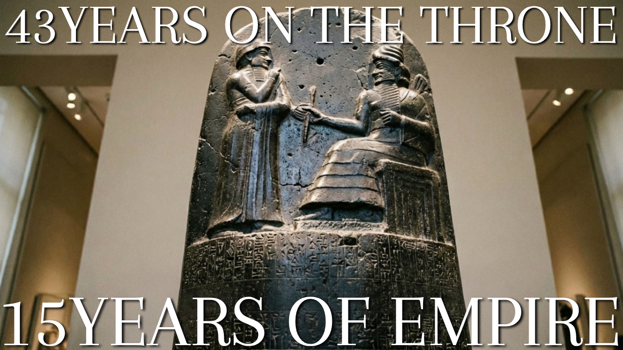
Somewhere in a museum case you have probably seen a black stone pillar, taller than a person, covered from shoulder to base in dense wedge-shaped writing. A label nearby says it carries the laws of Hammurabi. Most visitors read that label, nod, and move on.
The pillar is worth stopping for, but not for the reason the label suggests. It is not the oldest law text from Mesopotamia, it may never have functioned as legislation in the way we assume, and the man who commissioned it was a competent regional warlord for thirty years before he was anything more. What makes his era extraordinary sits in storage rooms rather than display cases: tens of thousands of clay tablets recording loans, marriages, lawsuits, harvest yields, military intelligence, school exercises, private quarrels, and complaints about the quality of delivered copper.
This is the Old Babylonian period, and it is the first stretch of human history from which we can hear ordinary voices in volume. Not just royal boasts carved for posterity, but a mother scolding her son about his clothing allowance, a merchant explaining why a shipment is late, a woman recording the exact silver value of the furniture she brought into a marriage.
The questions that bring most readers here
If you have read more than one book about ancient Mesopotamia, you have already run into a problem. The dates do not match. One source gives the period as 2004 to 1595 BCE, another as 1894 to 1595, a third writes about 1880 to 1595, and a fourth quietly shifts every date down by sixty-four years without explaining why. This is not sloppiness. It reflects two separate disagreements, one about what the label names and one about how the absolute calendar is anchored, and both have reasonable answers that this book lays out in full.
A second question follows quickly. Was this an empire or just a period? The phrase Old Babylonian empire appears constantly, yet the territory Hammurabi controlled at his death lasted barely a decade in its full extent and had already fractured under his son. Calling it an empire is defensible, but only if you are precise about what kind.
Then there is the question of what survives. If Babylon was the capital of this world, why does almost nothing from Hammurabi’s city exist? Why do museums display Old Babylonian objects found at Susa, Sippar, Mari, Ur, and Nippur, but hardly anything from Babylon itself? The answer involves a rising water table, a later king’s building programme, and a great deal of bad luck, and it shapes everything historians can and cannot say.
Finally, readers want to know why it ended. Babylon fell to a Hittite raid, but the raiders went home and left the city to someone else. Long before that raid, the southern half of the kingdom had emptied out. Cities that had been continuously occupied for two thousand years stopped producing documents within a decade of one another. That collapse is the genuinely mysterious part, and the explanations on offer range from soil chemistry to river hydrology to fiscal exhaustion.
What you get from reading this
This book is organised to answer those four questions properly, and then to keep going into the material that makes the period worth knowing for its own sake. You will finish it able to explain why competing date schemes exist and which one the scientific evidence currently supports. You will know how a silver-denominated economy without coins actually settled a debt, what a scribe learned in his first year of school, how a woman in a walled religious quarter at Sippar came to control twenty-five hectares of farmland, and what the difference is between the divination that a king used to decide on a campaign and the prophetic outbursts that terrified the palace at Mari.
You will also get a clear sense of the boundary between what is known and what is asserted. Popular accounts of this period are full of confident claims that specialists abandoned decades ago. The Burney relief is not securely identified as any particular goddess. Plimpton 322 may or may not be a trigonometric table, and the majority view among Assyriologists is that it is not. Salinization did not straightforwardly kill Sumerian agriculture. Wherever a claim is contested, this book says so and explains what the argument turns on.
Where the evidence is genuinely rich, the detail is worth having. The Mari palace correspondence lets us reconstruct a diplomatic system in which small kings measured their standing by how many other kings followed them. The Sippar contracts let us count how often women appear as principals in property transactions. The school tablets from one excavated house at Nippur let us reconstruct the order in which a child learned to write. Very little of the ancient world can be examined at this resolution.
How the book is arranged
The first three chapters build the frame: what the label means, how the dates are established, and what the political and physical map looked like. Chapters four through nine run the political history from the collapse of the last Sumerian state through the rise of Babylon and the empire’s administration. Chapters ten through fourteen turn to law, money, land, cities, and family, which is where the documentation is thickest.
The next stretch covers religion, divination, language, education, mathematics, and literature, in that order, because each depends on the one before it. Art gets its own chapter. The final three chapters follow the decline, the fall, and the modern rediscovery of the whole subject, including a practical guide to the reference works and open text corpora that let you check any of this yourself.
One note on names and dates before we start. Mesopotamian names look forbidding in transliteration and are often spelled several ways in the literature. This book uses the most common English forms and explains a name’s meaning where the meaning matters. Dates follow the Middle Chronology, which the current scientific evidence supports, and are marked as approximate because they are.
What “Old Babylonian” Actually Names: The Old Babylonian Time Period Defined
No Babylonian ever described himself as living in the Old Babylonian period. The phrase belongs entirely to modern scholarship, invented in the nineteenth century by philologists who needed a way to sort an enormous and undated mass of clay tablets into rough historical bins. Understanding what the term was built to do explains most of the confusion surrounding it.
The first Assyriologists faced a peculiar problem. They had recovered documents in a language, Akkadian, that had clearly changed over time in the way that Latin or English change over time. Spelling conventions shifted, grammatical forms fell out of use, new vocabulary appeared. Before anyone could write a history, the material had to be arranged by linguistic stage, and the labels chosen for those stages were Old, Middle, and Neo, applied separately to the northern dialect called Assyrian and the southern one called Babylonian.
So the word Old in Old Babylonian is not a judgement about primitiveness or antiquity in any general sense. It marks a stage of a language. Old Babylonian Akkadian is the southern dialect in its earliest well-documented form, and it happens to be the stage that later Mesopotamian scholars themselves regarded as classical, the way Cicero’s Latin became the standard for later Latin writers.
Three different things the same two words describe
The trouble starts when a linguistic label gets used for a political period, an archaeological horizon, and a dynasty, all at once. Each usage is legitimate and each produces different dates. A reader who does not know which sense an author intends will find the numbers irreconcilable.
In the narrowest sense, the term names the First Dynasty of Babylon, the line of Amorite kings that ruled the city from its establishment as an independent kingdom until the sack that ended it. On that reading the period runs from roughly 1894 to 1595 BCE, a span of about three centuries, and everything before Babylon’s independence belongs to something else.
In a broader political sense, the term covers the whole era between the fall of the Third Dynasty of Ur and the sack of Babylon. This is the usage that produces the bracket beginning around 2004 or 2003 BCE. Its logic is that the political system of the intervening four centuries was continuous in kind, a landscape of competing Amorite-led kingdoms in which Babylon happened to be the eventual winner, and that treating the first century of that landscape as a separate Isin-Larsa period is an artificial cut.
In the archaeological and textual sense, the term names a horizon of material culture and document types: a distinctive script, a distinctive tablet format, mould-made terracotta plaques, a recognisable seal style, a specific range of contract formulas. Excavators use the label this way constantly. A layer can be called Old Babylonian on the strength of its pottery and its tablets without anyone knowing which king was reigning.
Frayne’s bracket and why it opens with a fall
The single most-consulted reference edition of the period’s royal inscriptions makes the broad choice explicit in its title. Douglas Frayne’s volume in the Royal Inscriptions of Mesopotamia series is called Old Babylonian Period, and its subtitle gives the years 2003 to 1595 BCE. That volume, published by the University of Toronto Press, runs to more than eight hundred and fifty pages and assembles the inscriptions of every dynasty in the region across those four centuries.
Frayne’s arrangement tells you why he drew the line there. The inscriptions are grouped by dynasty, then by ruler, then chronologically within each reign, and the earliest groups are the kings of Isin and Larsa, not the kings of Babylon. Each text gets an introduction covering contents, place of origin, and relative dating, a catalogue of the surviving exemplars, a commentary, a bibliography, and a transliteration facing an English translation. Building that apparatus for Isin and Larsa alongside Babylon only makes sense if you regard them as belonging to a single historical formation.
The starting year itself is the conventional date for the fall of Ur, the collapse of the last Sumerian-speaking imperial state. What ended there was a highly centralised administration that had tried to run southern Mesopotamia as a single accounting system, taxing and redistributing on a scale not attempted again for centuries. Everything that follows is a response to its absence.
That choice of starting point has a consequence worth stating plainly. If you accept it, then the Old Babylonian period spent its first two centuries with Babylon as a minor town of no particular importance, and the label describes an era named retrospectively after the city that eventually dominated it. The same thing happens in other periodisations. Nobody in the early Roman Republic knew they were living in Roman history.
The bracket that starts later, and the one that starts in between
Scholars who prefer the narrower dynasty-based reading are making a different and equally defensible argument. Their point is that a period should be named for something that actually existed during it, and the Old Babylonian state did not exist before Babylon became independent. On this view the four centuries from Ur’s fall should be split, with an Isin-Larsa period covering the first stretch and the Old Babylonian period proper beginning with Sumu-abum, the first king in Babylon’s dynastic list.
A third convention starts around 1880 BCE, and it reflects a technical caution rather than a conceptual disagreement. The earliest kings of Babylon’s dynasty are poorly attested. Sumu-abum may not have ruled Babylon itself at all, and some specialists now treat him as an Amorite leader whose name was attached to the city’s king list later. Starting the period with the reign of Sumu-la-El, whose building inscriptions and year names are solidly documented, avoids resting a chronology on a figure who may be partly an artefact of later record-keeping.
None of these conventions is wrong. When you encounter dates that do not match, the first question to ask is not which author made a mistake but which of the three referents that author has in mind. The end date is the one thing everyone agrees on, because it corresponds to a single datable event with an unambiguous archaeological signature.
What the term excludes
It is easy to lose track of how much of famous Babylonian history sits outside this period entirely. The Babylon of the Hanging Gardens, the Ishtar Gate, Nebuchadnezzar, and the Judean exile is Neo-Babylonian, more than a thousand years later. The gap between Hammurabi and Nebuchadnezzar II is longer than the gap between Nebuchadnezzar and the present day.
The Tower of Babel tradition, the astronomical achievements that produced accurate planetary tables, and the great compendium of creation known as Enuma Elish in its finished form all belong to later stages. So does the mature Epic of Gilgamesh in the twelve-tablet version most translations follow. Old Babylonian versions of Gilgamesh exist and are strikingly different, which is one of the more interesting facts in the whole field.
Going the other way, the period excludes Sumer’s classical age. The great Sumerian cities were already ancient when this period began, and their political independence had ended centuries earlier. What the Old Babylonian period preserves of Sumer is a literature copied by schoolboys in a language none of them spoke at home, which is an odd and revealing kind of survival.
Eleven kings, and a list assembled by someone else
The dynasty the narrow definition names consists of eleven rulers: Sumu-abum, Sumu-la-El, Sabium, Apil-Sin, Sin-muballit, Hammurabi, Samsu-iluna, Abi-eshuh, Ammi-ditana, Ammi-saduqa, and Samsu-ditana. Spread across roughly three centuries, that works out to an average reign of about twenty-seven years, which is long by any pre-modern standard and long enough that historians have occasionally wondered whether the list is complete.
The sequence does not come to us from the dynasty itself. It survives in king lists copied centuries later, documents that had their own purposes and were perfectly capable of smoothing an untidy succession into a clean father-to-son line. What keeps the reconstruction honest is a separate and far better class of evidence: year names.
Mesopotamian scribes did not number years from a fixed epoch. They named each year after a memorable event from the year before, so a contract might be dated to the year in which the king built a particular temple wall, or dedicated a throne, or destroyed a named city. Scribes then compiled these names into sequential date lists so that anyone reading an old document could work out where it sat in time.
Those lists are what allow a modern historian to say that Hammurabi reigned forty-three years, and to know what he claimed to have done in each of them. They are also why the political narrative of this period is unusually detailed for its age. When a king’s thirtieth year is named after the defeat of a specific enemy army, that is a contemporary statement, not a later tradition.
A term that travels further than the kingdom did
One more source of confusion deserves flagging, because it catches out readers who are otherwise following the argument. Specialists routinely apply the label to material from places Babylon never ruled, and sometimes to places its armies never reached.
Tablets from Mari on the middle Euphrates, from Eshnunna in the Diyala valley, from Susa in southwestern Iran, and from sites across northern Syria are all described as Old Babylonian. The usage is chronological and cultural rather than political: it means the documents belong to the same writing tradition, the same broad linguistic stage, and the same span of centuries. A text can be Old Babylonian in this sense while having been written by a scribe working for a king at war with Babylon.
There is a parallel mismatch with the vocabulary archaeologists use. Excavators working in Syria and the Levant divide the same centuries into phases of the Middle Bronze Age, a grid built from pottery sequences and settlement patterns rather than from kings and tablets. The two systems overlap without aligning cleanly at their boundaries, so a site report may date a building to Middle Bronze II while a text from its floor is dated by an Old Babylonian year name. Both statements are correct and they are answering different questions.
A related exclusion trips up readers coming from biblical studies. Abraham, if the traditions about him have any historical setting at all, would belong somewhere in these centuries, and the Mari archives were once mined enthusiastically for parallels to patriarchal narratives. That enthusiasm has cooled considerably. The parallels turned out to be either generic features of second-millennium Near Eastern society or artefacts of selective reading, and the mainstream position now treats the Mari material as evidence for Mari rather than as background illustration for anything else.
Why the label has held up
Given the confusion, it is fair to ask why the term persists. The answer is that the underlying unit is real. Between the fall of Ur and the sack of Babylon, the Mesopotamian world had a consistent character: multiple competing kingdoms rather than a single hegemon, rulers with Amorite names and Akkadian titles, an economy denominated in silver by weight, a legal culture that documented private transactions obsessively, a scribal system teaching a dead language to living children, and a body of literature that later Mesopotamians treated as classical.
There is also a practical reason the term endures. Anyone who works with this material needs a shorthand for a specific combination of features, and no better candidate has been proposed. Suggestions to replace it with a neutral century-based scheme have never caught on, partly because the centuries themselves are the disputed quantity.
That coherence is what specialists are pointing at when they use the term, and it is why an excavator can date a layer to the period from its pottery and a philologist can date a tablet from its grammar and both mean roughly the same thing. The label survives because the thing it names has edges.
Those edges, however, are edges in a sequence of years, and the years themselves rest on a chain of inference that is far less secure than most readers assume. Before going further into what happened, it is worth establishing how anyone knows when it happened.
The sections above covered what the label means and what it excludes. The next question is spatial: where did this world sit, and how did geography shape its politics?
Old Babylonian Mesopotamia Map: Rivers, Cities, and the Shape of Power
Any map of Old Babylonian Mesopotamia that shows the Tigris and Euphrates as two firm blue lines is lying to you in a way that matters. The rivers of the southern plain were not channels in the modern sense. They were braided, shifting, silt-choked systems that split into multiple branches, changed course over decades, and were extensively rebuilt by human hands into networks of canals that carried the name of the river along with its water.
A city on the Euphrates in 1800 BCE might sit on a branch that had been the main channel a century earlier and would be a minor watercourse a century later. When the water moved, the city’s economic position moved with it. This is not background scenery. It is one of the central causal factors in the period’s political history, and it becomes the decisive one at the end.
Why the map is a map of water
Southern Mesopotamia receives too little rainfall to support cereal agriculture without irrigation. The plain is flat, the soil is fertile alluvium deposited by the rivers themselves, and the entire agricultural system depends on lifting or diverting river water into fields at the right moment. Everything that follows from that is structural.
Irrigation requires coordination beyond the household. Canals have to be dug, cleared of silt annually, and defended, and water rights have to be allocated among users along the same channel. That coordination is one of the reasons Mesopotamian society produced dense urban settlement and elaborate written administration earlier than anywhere else, and it is why control of a canal was a political fact rather than an engineering detail.
The timing works against the farmer. The Euphrates and Tigris flood in spring, when the snows melt in the Anatolian highlands, which is close to harvest rather than to planting. The flood is therefore a threat as much as a resource, and the water needed for the autumn sowing has to be stored or drawn from a river running low. Mesopotamian agriculture was a system of managing water that arrived at the wrong time.
Irrigation in a flat, hot, poorly drained plain concentrates dissolved salts in the topsoil. Fallowing and careful drainage can manage this, and Mesopotamian farmers knew how, but the margin is thin and mismanagement is cumulative.
The southern plain and its cities
The south, the region the Babylonians themselves called Sumer, held the oldest cities in the world. Ur, Uruk, Larsa, Lagash, Nippur, Isin, Kish, and Eridu were already ancient by this period, some of them by two thousand years. They sat close together by modern standards, a day or a few days apart, each with its own patron deity, its own temple estate, and a long memory of independence.
Nippur held a special position that was religious rather than political. It was the seat of Enlil, the god whose authorisation legitimated kingship over the land, and a ruler who wanted to be recognised as king of Sumer and Akkad needed to control it and to endow its temples. Nippur was also the great centre of scribal learning, which is why the best evidence for how scribes were trained comes from there.
North of Sumer lay the region called Akkad, centred on the middle stretch of the plain where the Tigris and Euphrates come closest together. Babylon sits here, as do Sippar on the east bank of the Euphrates, Kish, Borsippa, and Dilbat. This is the zone that would become the core of the Babylonian state, and it had a real geographical advantage: it commanded the point where routes from the Diyala valley, from the middle Euphrates, and from the south all converge.
Both regions were spoken of together in royal titles as Sumer and Akkad, a formula inherited from earlier empires and used throughout this period by any king with pretensions. When Hammurabi claimed that title he was invoking a political tradition several centuries old.
The northern half and the rain line
Travel a few hundred kilometres up the Tigris and the agricultural regime changes completely. Northern Mesopotamia, the region later called Assyria, receives enough winter rainfall in most years to grow barley without irrigation. That single fact produces a different society: dispersed villages rather than a few huge cities, different property patterns, different vulnerabilities.
Rain-fed farming does not require the collective infrastructure that irrigation demands, so northern polities did not develop the same style of centralised hydraulic administration. What they had instead was position. The north sits astride the routes running west into Syria and north into Anatolia, which is why the city of Assur, itself in a marginal agricultural setting, made its living as a trading power rather than an agricultural one.
The rain line is not a fixed boundary and it moves with climate. A run of dry years pushes it north and destroys the viability of farming in the transitional zone, a fact that has been invoked to explain several episodes of disruption in the region’s history. In the century before this period began, the northern plains had already gone through one such episode.
The political map when Hammurabi came to the throne
Set aside for a moment the later empire and picture the region as it stood around 1800 BCE. There is no dominant power. Instead there are perhaps a dozen kingdoms of comparable weight, each with a capital city, a hinterland of dependent towns, a treaty network, and an army measured in the low thousands.
In the far south, Larsa under Rim-Sin controlled Ur, Uruk, and the Persian Gulf trade, having absorbed its old rival Isin. In the middle, Babylon held a compact territory of a few dozen kilometres’ radius. East, in the Diyala valley that leads up towards the Iranian plateau, sat Eshnunna, a wealthy and aggressive kingdom that had produced its own law collection generations before Hammurabi produced his.
Upriver on the Euphrates, at the point where the route to Syria leaves the river, stood Mari, controlling traffic in both directions. Further west and north, Yamhad, with its capital at Aleppo, was the greatest power in Syria and probably the strongest single kingdom in the whole region. Qatna held central Syria, and beyond the Zagros to the east lay Elam, a distinct civilisation with its own language, its own long history, and a habit of intervening in Mesopotamian politics.
Assur and Ekallatum on the Tigris had recently been absorbed into the northern kingdom assembled by Shamshi-Adad, and Anatolia hosted a network of Assyrian merchant colonies operating under agreements with local rulers. That was the world into which Babylon expanded, and it explains why the expansion took so long. Every conquest required either defeating or outmanoeuvring a state of roughly equal size.
The space between the cities
Maps of this period conventionally show cities as dots on an otherwise empty plain, which produces a badly misleading picture. The land between the settled zones was not empty. It was occupied by mobile pastoral groups moving flocks between seasonal grazing, and those groups were politically significant in ways that dots on a map cannot show.
The Mari letters are unusually explicit about this, because Mari’s kings ruled a territory in which mobile and settled populations were thoroughly interleaved. Tribal confederations appear in the correspondence as entities the palace had to negotiate with, tax, recruit from, and occasionally fight. Their leaders held recognised positions, their movements had to be tracked, and their willingness to supply fighting men could decide a campaign.
The relationship was not a simple opposition of nomad against farmer. Individual families moved between the two modes depending on circumstance, tribal groups owned agricultural land, and the ruling dynasties of the period, including Babylon’s, carried tribal names and traced descent from tribal ancestors. A king could be simultaneously the ruler of a city and the head of a lineage with pastoral affiliations.
Distance, and how long it took
Scale is easy to misjudge. The core of Babylonia is small. The distance from Sippar in the north to Ur in the far south is on the order of three hundred and fifty kilometres, comparable to the length of England. An army could cross it in a matter of weeks, and a messenger with relays considerably faster.
Beyond that core the distances grow quickly. Mari lies several hundred kilometres up the Euphrates from Babylon, far enough that the two cities operated in overlapping but distinct political spheres. The Assyrian trade route from Assur to Kanesh in central Anatolia ran roughly six hundred miles, and the donkey caravans that worked it took something on the order of six weeks each way, which tells you a good deal about the value density of the goods being carried.
Rivers carried freight downstream cheaply and upstream expensively, which biased the whole system. Bulk goods moved south with the current; the return journey was made overland or with boats that were sometimes dismantled and sold for timber at the destination. Grain, the heaviest commodity in the economy, was therefore easier to concentrate in the north of the plain than in the south, another quiet structural advantage for the region around Babylon.
The southern edge, and what came in by sea
The plain does not simply stop at the Gulf. Ur and the other far-southern cities sat close to a coast fringed with marshland, and that access to salt water gave the region a commercial character the inland cities lacked. Ships worked south along the Arabian shore to Dilmun, the entrepot on and around modern Bahrain, and from there connected to Magan in the Oman peninsula and, less directly, to the Indus valley.
Copper was the commodity that mattered most on this route. Mesopotamia has no metal ores of its own, and the copper that entered the southern cities by sea supplied a large part of the region’s tools and weapons. Merchants financed voyages with borrowed silver, formed partnerships to spread the risk, and settled accounts on return.
One of the best-known tablets from the entire period is a letter of complaint from a customer named Nanni to a copper dealer named Ea-nasir, accusing him of supplying inferior ingots, of treating a messenger with contempt, and of behaving as though the customer’s silver meant nothing to him. It was found at Ur, in what appears to have been Ea-nasir’s own house, along with other correspondence of a similarly unflattering kind. The document is often circulated as a curiosity, but it is also good evidence: it shows a private long-distance copper trade operating on credit, with quality disputes, agents, and enough documentation for a dissatisfied buyer to put his grievance in writing and expect it to have force.
What a reconstructed map cannot show you
Every published map of Old Babylonian Mesopotamia is a compromise. The coastline of the Gulf is uncertain and was probably further inland than today. Many identified sites cannot be securely matched to ancient names, and many ancient names known from texts cannot be matched to sites. The watercourses are reconstructions built from satellite imagery of relict channels, from the distribution of settlements, and from textual references to which city lay on which canal.
The best of these reconstructions are genuinely informative, and remote sensing has improved them considerably in recent decades by revealing buried channel traces invisible on the ground. But they should be read as hypotheses with error bars, particularly for the exact configuration of the Euphrates branches in any given century.
One implication is worth carrying forward. Because settlement in this landscape tracks water, the distribution of occupied sites is itself evidence for where the channels ran, and a sudden abandonment of a whole group of cities is evidence that something happened to their water. That inference will do a lot of work when the southern half of the kingdom empties out in the eighteenth century.
Beyond the Framework: What the Full Version Covers
What you have just read is the opening framework of a much larger work — the definitional groundwork and the geographic stage. The full version goes far beyond this frame. It reconstructs the political narrative of Hammurabi’s conquests and the empire’s structural fragility, examines the Laws of Hammurabi as an object and a genre rather than a simple legal code, traces how a silver economy without coins actually functioned and why kings periodically cancelled debts, and follows the scribal education system from a child’s first wedge-impressions through the copying of Sumerian literature in a language no student spoke at home. The final chapters investigate why the southern cities emptied out, what the Hittite raid actually ended, and how the modern recovery of this material works in practice.
Read the complete edition on Kindle to follow the evidence beyond these opening chapters, or choose the Liberal Arts Bundle to explore this book together with other English-language guides.
The complete edition on Kindle: the political history, laws, economy, and daily life of Old Babylonia
Liberal Arts Bundle: explore this book alongside a growing collection of English-language guides
A Guide to Exploring Ancient Mesopotamia
Start with the city-states
- Early Dynastic Mesopotamia: How Sumerian Civilization Built the First City-States — Trace the cities, writing systems, and institutions that developed before Babylon became a major power.
Follow the later empires
- Understanding the Neo-Babylonian Empire in Ancient Mesopotamia — Distinguish Hammurabi’s Old Babylonian kingdom from the much later empire of Nebuchadnezzar.
- Achaemenid Empire Meaning, Pronunciation, and Origins Before Cyrus — Explore the Persian dynasty’s name and the Near Eastern states that preceded Cyrus’s expansion.

コメント