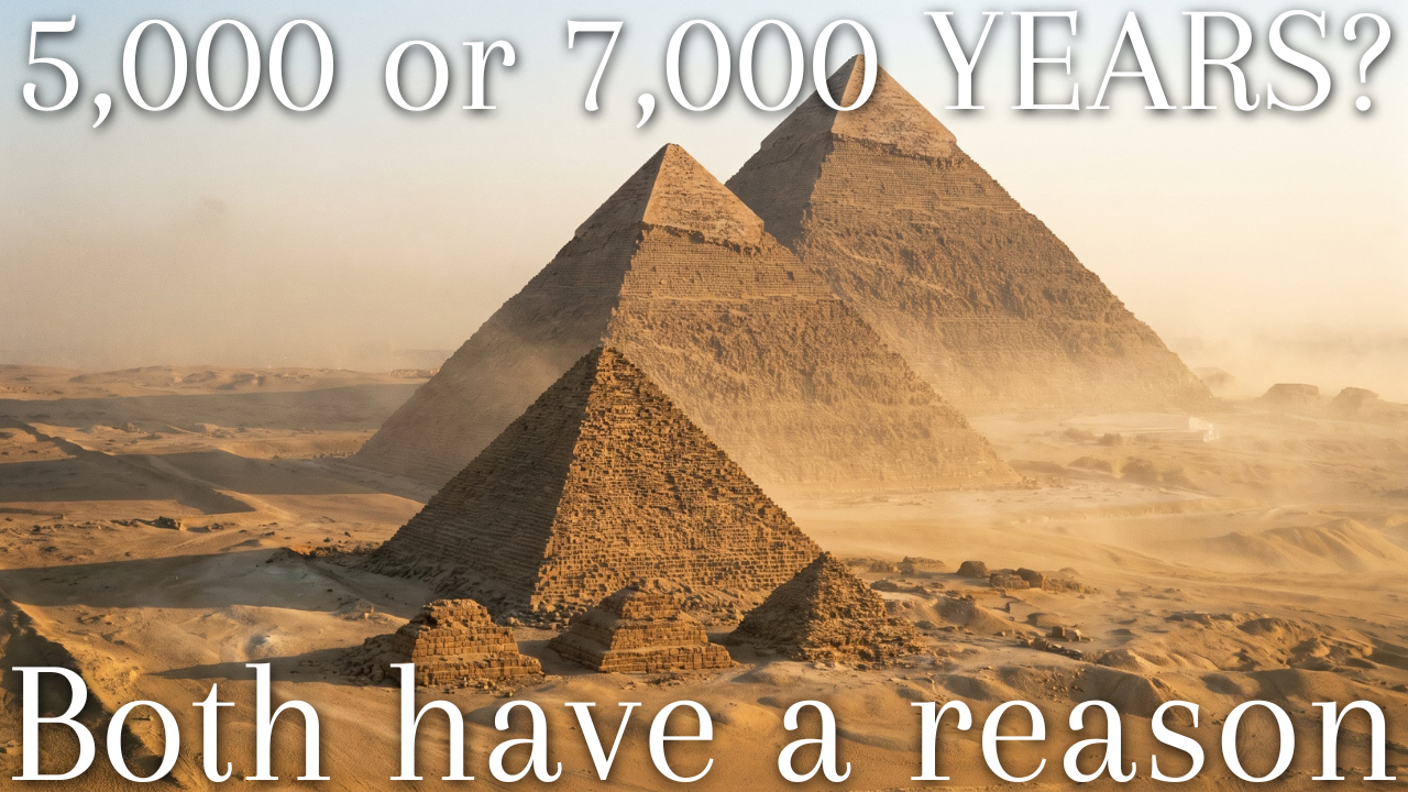
A date is only useful when you know what it is dating. Before memorising another number for ancient Egypt, try asking a more precise question: are you looking for the first villages, the first writing, or the first united state? This free reading brings the chronological question together with the map, so you can approach both with a clear frame of reference.
Watch the English Explainer
The video introduces the dates and geography, then works through common questions and misconceptions.
The complete edition on Kindle: continue through ancient Egyptian history, religion, and daily life.

Liberal Arts Bundle: explore this book alongside other English-language guides.

- Egyptian Civilization: When Did It Begin?
- Counting backwards from today
- What happened around 3100 BC
- Writing arrives first
- Three defensible starting dates
- Why the uncertainty cannot be removed
- The names this civilization goes by
- What the first dynasty actually looked like
- Three thousand years, put in perspective
- Where the popular start dates come from
- How the beginning was remembered later
- The Nile and the Geography of Egyptian Civilization
- The inundation as an annual subsidy
- Measuring the flood, and taxing it
- The shape of the habitable zone
- Deserts as walls
- Where Egypt sits on a modern map
- Why civilization emerged here rather than elsewhere in Africa
- What the river looks like now
- The river as a mental map
- Upstream: the cataracts and what lay beyond
- Continue Exploring Ancient Egypt
- Related Reading on Early Civilizations
Egyptian Civilization: When Did It Begin?
The conventional answer is around 3100 BC, when Upper and Lower Egypt were brought under a single ruler and the first dynasty began. That date appears on museum labels, in school textbooks, and at the top of nearly every timeline. It is a defensible answer. It is also an answer to a narrow question: not when Egyptians appeared, and not when Egyptian culture formed, but when the Egyptian state came into existence.
Separate those three questions and the apparent contradictions dissolve. Farming villages existed in the Nile Valley for at least two and a half millennia before unification. Recognisably Egyptian religious symbols, pottery styles and burial practices developed over roughly eight centuries before the first dynasty. Writing appears slightly before the unified state rather than after it. Each of those thresholds gives a different, correct answer to "when did Egyptian civilization start", which is why the numbers people quote range so widely.
Counting backwards from today
The arithmetic that produces the familiar headline figures is worth doing explicitly, because it is where most of the popular confusion enters. Measured from the unification, Egyptian civilization began roughly 5,100 years ago. Measured from the first substantial farming settlements in the valley, closer to 8,000. Measured from the cattle-herding camps of the Western Desert that fed into the valley cultures, around 9,500.
Round numbers have a gravitational pull. "5,000 years of history" is repeated so often that it has become the default, and it is a reasonable shorthand for the pharaonic state. When a source says Egyptian civilization is 7,000 years old, it is almost always counting from the Neolithic villages rather than from the first king, and when a source says 3,000 years, it is usually counting the duration of the pharaonic period rather than its starting distance from the present.
What happened around 3100 BC
The event traditionally placed at that date is the union of two territories with genuinely different characters. Upper Egypt was the narrow southern valley, from the First Cataract at Aswan down to roughly the latitude of modern Cairo: a ribbon of floodplain rarely more than twenty kilometres wide, hemmed by cliffs. Lower Egypt was the Delta, a broad fan of marshland and distributary channels opening onto the Mediterranean.
Their unification produced the political vocabulary Egypt used for the next three thousand years. The king wore two crowns — the tall White Crown of the south and the flat-backed Red Crown of the north — and held titles that named him ruler of both lands. Egypt's own name for itself, Kemet, meant "the black land", the dark alluvial soil, as opposed to Deshret, the red desert beyond it. The state's founding idea was that one man held together two things that were naturally separate.
Whether a single king achieved this in a single campaign is another matter. The evidence points to a process rather than an event: a sequence of increasingly powerful Upper Egyptian rulers extending control northwards over several generations, with Narmer marking the point at which the result became stable and documented. Egyptian tradition later compressed all of it into one founder, as founding traditions usually do.
Writing arrives first
The most interesting complication to the standard date comes from a cemetery at Abydos, in Upper Egypt, and it reverses an assumption many readers hold. Excavations at Umm el-Qa'ab uncovered a tomb designated U-j, belonging to a ruler conventionally called Scorpion I, who was active during the late Naqada period. Inside were small bone and ivory tags, pottery vessels and clay seal impressions bearing hieroglyphic signs.
Those signs have been dated to roughly 3320 to 3150 BC, which places them before the unified state. They are short — apparently estate names, place names and commodity labels — but they are unmistakably the ancestors of the script that would later cover temple walls. The implication is that Egyptian writing was invented not by a unified kingdom needing to administer itself, but by competing pre-unification polities needing to label and track goods.
This matters for the "which civilization is oldest" argument that generates so much heat. The Abydos tags are close enough in date to the earliest Mesopotamian tablets that the question of priority cannot currently be settled from the archaeological record, and specialists are properly cautious about it. What can be said is that two independent writing systems emerged in the same few centuries at opposite ends of the Fertile Crescent, and that Egypt's was in use before its first dynasty.
Three defensible starting dates
Rather than pick one, it is more useful to hold three in mind and know which each source is using.
| Threshold | Approximate date | Years before present | What it marks |
|---|---|---|---|
| Neolithic villages in the valley | c. 6000 BC | c. 8,000 | Farming, permanent settlement, domesticated cattle and cereals |
| Earliest hieroglyphic signs | c. 3320–3150 BC | c. 5,300 | Administrative writing, ranked society, proto-states |
| Unification and First Dynasty | c. 3100 BC | c. 5,100 | Single kingship, national institutions, pharaonic Egypt begins |
A school answer should normally give the third date, because that is what "the Egyptian civilization" conventionally names. A well-informed answer mentions the second. An answer that knows the field mentions that all three are approximate.
Why the uncertainty cannot be removed
Egyptian scribes never counted years from a fixed epoch the way the Gregorian calendar counts from a notional year one. Dates were expressed as "year 7 of King So-and-so", which is precise within a reign and useless between reigns unless you know the reign's length and its position in the sequence. Rebuilding a continuous timeline therefore means assembling king lists — the Turin Canon, the Palermo Stone, Manetho's Greek summary, temple inscriptions — and reconciling them where they conflict, which is often.
Radiocarbon dating helps, and modern Bayesian modelling of large sample sets has tightened the Old Kingdom considerably, but it brings its own uncertainty range and depends on secure archaeological context. Astronomical anchors, chiefly records of the heliacal rising of the star the Egyptians called Sopdet, help fix a few points, though they require assumptions about the observer's latitude. The result is a chronology that is firm in its sequence, reliable within a few decades for the New Kingdom, and approximate to within a century or so at the beginning.
The names this civilization goes by
Egypt has been called many things by many people, and the aliases are worth untangling because they turn up in exam questions and museum labels alike. Egyptologists frequently refer to it as the Nile Valley civilization, grouping it with the other great river-based societies of the ancient world. In comparative history courses it appears as one of the four riverine civilizations, alongside Mesopotamia, the Indus and the Yellow River.
The Egyptians themselves used Kemet, the black land. Their southern neighbours and later Greek visitors used other terms entirely: the Greek Aigyptos, from which every modern European name descends, probably derives from a name for the city of Memphis, Hut-ka-Ptah, the temple of the soul of Ptah. The Arabic name, Misr, has Semitic roots far older than Islam and appears in Akkadian and Hebrew texts as a designation for the country.
Two further labels cause confusion. "Pharaonic Egypt" narrows the term to the period of native and foreign kingship from the First Dynasty to the Roman annexation, excluding the predynastic era. "Ancient Egypt" in museum usage often stretches to include the Greek and Roman phases, which is why a mummy portrait painted in a Roman style can appear in an Egyptian gallery without any inconsistency.
What the first dynasty actually looked like
There is a temptation to picture the earliest Egyptian state as a smaller version of the pyramid age, and the archaeology does not support it. The first two dynasties, spanning roughly four centuries, built in mudbrick rather than dressed stone. Royal tombs at Abydos were subterranean brick chambers under low rectangular superstructures, elaborate by the standards of the preceding centuries but nothing like the later monuments.
Those early royal burials carry a detail that modern readers find hard to read past. Around the tombs of several First Dynasty kings lie rows of subsidiary graves, containing servants, officials and in some cases dwarfs and dogs, apparently interred at the same time as the king. The practice — retainer sacrifice — appears at the very beginning of Egyptian kingship and then disappears within a few generations, replaced by figurines and painted substitutes.
Egyptian religion routinely converted a literal act into a symbolic representation and treated the representation as equally effective. Real servants became model servants; real offerings became painted offerings; a real door became a false door carved in a tomb wall. The logic that produced shabti figurines fifteen centuries later was already operating in the First Dynasty.
Three thousand years, put in perspective
The duration of pharaonic Egypt is difficult to feel rather than merely state, so a comparison helps. Cleopatra VII died in 30 BC, which is closer to the present day than to the building of the Great Pyramid. When she ruled, the pyramids of Giza were already about 2,500 years old — older to her than the Roman Empire is to us.
Tutankhamun, whose tomb goods define popular images of Egypt, lived about 1,300 years after Khufu. The scribes who copied the Maxims of Ptahhotep in the New Kingdom were copying a text they regarded as ancient wisdom, written in a form of the language they had to study as a classical dialect. Egypt spent much of its history being a country with a deep past, self-consciously imitating its own earlier periods.
This has a practical consequence for anyone studying the subject. A statement that begins "the ancient Egyptians believed" or "in ancient Egypt, people wore" is almost always too broad to be true. Burial customs, artistic style, military technology, the status of the priesthood and the reach of royal power all changed substantially, and the changes are the interesting part.
Where the popular start dates come from
Three specific claims circulate widely enough to deserve direct treatment. The first is that Egyptian civilization began in 3150 BC, a figure that comes from one particular estimate of Narmer's accession and is no more authoritative than the 3100 or 3000 BC given elsewhere. The spread reflects competing estimates of early reign lengths, not competing theories about what happened.
The second is that Egypt is 7,000 years old. That figure counts from the Neolithic phase, and Egyptian official tourism material sometimes uses it, which is why travellers encounter it on site signage. It is a legitimate count of human occupation and agriculture, not of the state.
The third claim is the strangest and the most persistent: that the civilization is far older than 5,000 years, tens of thousands of years even, on the basis of supposed water erosion on the Great Sphinx or alleged astronomical alignments. That argument has been tested by geologists and archaeoastronomers and does not survive contact with the stratigraphy, the tool marks or the quarry sequence at Giza, all of which tie the monument firmly to the fourth dynasty.
How the beginning was remembered later
Egyptians kept their own account of their origins, and it is a useful corrective to any assumption that they thought historically in the modern sense. The Turin Royal Canon, a New Kingdom papyrus listing rulers in sequence, begins not with a human king but with gods, then demigods, then the spirits of the dead, and only then with Menes, the traditional first mortal ruler. Thousands of years are assigned to the divine reigns.
Manetho, an Egyptian priest writing in Greek in the third century BC, produced the dynastic scheme still in use — thirty-one dynasties from Menes to Alexander — and he too prefaced it with dynasties of gods. Modern Egyptology kept his numbering because it is convenient and roughly corresponds to real changes in ruling families, while discarding his mythological prologue. Every reference to "the Eighteenth Dynasty" is therefore an inheritance from a Ptolemaic priest's summary of temple records that no longer exist.
Whether Menes was Narmer, or Narmer's successor Hor-Aha, or a composite of both, has been debated for over a century without resolution. The debate is not idle: it determines whether the objects bearing Narmer's name belong to the last predynastic ruler or the first pharaoh, and museum labels differ accordingly.
Keep the question of dates beside a map as you read the second section. The two belong together: a timeline gives events their sequence, while a map helps you see the setting in which those events took place.
The Nile and the Geography of Egyptian Civilization
Egypt is a desert country with a garden running through it. Rain is negligible across almost the entire territory, and without the Nile the land between the Mediterranean and the First Cataract would support roughly what the Libyan Desert supports today: scattered oasis populations and nothing resembling a state. Every distinctive feature of Egyptian civilization — its agricultural surplus, its calendar, its capacity to move multi-tonne stone blocks, its political unity, even its afterlife imagery — traces back to the behaviour of one river.
The river's two main branches collect water from two different climate systems. The White Nile rises in the equatorial lakes of East Africa and delivers a relatively steady flow. The Blue Nile rises in the Ethiopian highlands, where summer monsoon rains fall on volcanic soils, and it contributes both the bulk of the annual flood and nearly all of the silt. The two meet at Khartoum and run north as a single channel through Nubia and Egypt to the Mediterranean.
The inundation as an annual subsidy
Before the twentieth century, the consequence of that Ethiopian monsoon arrived in Egypt every summer with remarkable regularity. Water levels began rising in June, peaked in August and September, and spread across the floodplain and Delta to a depth of roughly a metre and a half. By October the water was retreating, leaving behind saturated ground and a fresh layer of mineral-rich silt.
Two properties of this flood mattered more than its size. It was predictable in timing, arriving within a window of a few weeks year after year, which allowed an entire agricultural and administrative calendar to be built around it. And it deposited fertiliser, which meant Egyptian fields could be cropped continuously for millennia without the soil exhaustion that has ended other agricultural systems.
The comparison with Mesopotamia is instructive, because the two civilizations are so often treated as interchangeable river societies. The Tigris and Euphrates flood in spring, before the harvest rather than after it, and they flood erratically — too little in some years, catastrophically in others, with a habit of changing course. Mesopotamian irrigation therefore required constant defensive engineering and produced salinisation problems that degraded southern farmland over centuries. Egypt's flood arrived at a convenient moment and flushed salts downstream rather than concentrating them.
Measuring the flood, and taxing it
A state that depends on a variable flood has an obvious interest in measuring it, and Egypt did so systematically. Nilometers — graduated measuring installations cut into riverbanks or into steps descending to the water, some housed within temple precincts — recorded the height of each year's maximum. An early example is credited to Senusret I, and at least twenty recording points were eventually distributed along the river, with the annual figures entered into palace and temple archives.
The purpose was fiscal as much as scientific. Flood height predicted harvest size, harvest size determined the grain tax, and the tax assessment could therefore be set before a single ear of wheat was cut. A high reading meant a good year and a heavier assessment; a low one meant reduced yields, reduced revenue, and in the worst cases famine. Officials were reading the river as a forecast of the treasury's position.
The range between a good flood and a disaster was narrower than one might expect. A shortfall of a metre or two across several consecutive years could pull harvests below subsistence across the whole country simultaneously — there was no second river basin to compensate.
The shape of the habitable zone
The Egyptian floodplain is extraordinarily thin. Through most of Upper Egypt the cultivable strip runs between two and twenty kilometres wide, walled by limestone and sandstone cliffs that rise directly from the fields in places. A traveller standing on the desert edge can often see both the river and the opposite cliff line, which is to say the entire width of the country at that latitude.
North of modern Cairo the valley opens into the Delta, historically a triangle of marsh, lagoon and braided channels covering a far larger area than the valley itself. Classical writers counted seven Nile mouths; today two main distributaries remain, the Rosetta and Damietta branches. The Delta was Egypt's richest pasture and its most exposed frontier, and the tension between a southern religious heartland and a northern commercial and military zone recurs throughout the political history.
This geography had a decisive administrative consequence. A single river running through a corridor with no navigable side valleys is the easiest possible territory to govern from one point: messages, officials, soldiers, taxes and building stone all travel the same route. Sailing boats went south with the prevailing north wind; rowing and the current carried traffic north. The hieroglyphic sign for travelling south is a boat with a sail raised, and the sign for travelling north is a boat without one.
Deserts as walls
Egypt's borders were defined less by treaties than by terrain, and for most of its history the terrain did the defensive work. To the west lies the Libyan or Western Desert, one of the driest regions on earth, crossed only along oasis chains. To the east, the Eastern Desert rises into the Red Sea mountains — harsh but useful, since it held gold, hard stone quarries and routes to the Red Sea coast.
To the south, the granite barrier of the First Cataract at Aswan interrupted navigation and marked the traditional frontier with Nubia. To the north lay the Mediterranean, which in the Bronze Age was a trade route rather than an invasion route. The only easy land approach was the northeastern corner, across northern Sinai into the Delta, and it is precisely there that Egypt built fortresses and fought most of its defensive wars.
The protective effect explains a peculiarity of Egyptian culture: an unusually strong sense that the world outside was disordered and dangerous, combined with an unusually long run of political continuity. Mesopotamian cities changed hands between competing powers repeatedly within a single century. Egypt went through nearly two thousand years before a foreign dynasty ruled the whole country.
Where Egypt sits on a modern map
For readers trying to locate all of this in present-day terms, the ancient heartland lies almost entirely within the Arab Republic of Egypt, in the northeastern corner of Africa, roughly between 22 and 31 degrees north. The Sinai Peninsula, politically Egyptian, is geographically part of Asia, which makes Egypt a transcontinental state and made ancient Egypt a natural bridge between Africa and the Levant.
The principal sites map onto modern places as follows.
| Ancient place | Modern location | Why it matters |
|---|---|---|
| Memphis | Mit Rahina, near Cairo | Administrative capital of the Old Kingdom; the Saqqara and Giza cemeteries served it |
| Thebes | Luxor | Religious capital from the Middle Kingdom; Karnak, Luxor Temple, Valley of the Kings |
| Akhetaten | Tell el-Amarna | Purpose-built capital of the Amarna period |
| Abydos | El-Balyana district, Sohag | Earliest royal cemetery; later the cult centre of Osiris |
| Elephantine and the First Cataract | Aswan | Southern frontier, granite quarries, Nubian trade gateway |
| Alexandria | Alexandria | Ptolemaic and Roman capital, Mediterranean port |
| Napata and Meroe | Northern Sudan | Kushite royal centres; source of the Twenty-fifth Dynasty |
One consequence of that last row deserves emphasis. A substantial part of the archaeology of Nubia — including the region that supplied Egypt with gold, soldiers and eventually a dynasty of pharaohs — lies inside Sudan, and part of Lower Nubia lies beneath Lake Nasser, flooded when the Aswan High Dam was completed in 1970.
Why civilization emerged here rather than elsewhere in Africa
The Nile did not always run through desert. During the early Holocene, a strengthened monsoon pushed rainfall far north into what is now the Sahara, supporting grassland, seasonal lakes and a population of hunters and cattle herders across territory that is now uninhabitable. The rock art of the central Sahara — cattle, giraffe, swimming figures — records that wetter world.
As the monsoon belt retreated southward over several millennia, those lakes dried and that population had to move. The Nile Valley was the nearest permanent water, and it absorbed people, herds and techniques from an enormous catchment. Aridity, in other words, concentrated a dispersed population into a narrow, highly productive corridor, and that concentration is what made complex society possible.
What the river looks like now
The relationship between Egyptians and the Nile has changed more in the past sixty years than in the preceding six thousand. The Aswan High Dam ended the annual inundation entirely, replacing it with regulated year-round irrigation. The benefits were substantial: protection from both drought and destructive floods, hydroelectric power, and the ability to crop land two or three times a year rather than once.
The costs are equally real. Silt that once fertilised the fields now settles behind the dam, so Egyptian agriculture depends on manufactured fertiliser; the Delta coastline, no longer replenished with sediment, is eroding; and salinity management has become a permanent engineering task. The flood that Egyptian religion treated as the visible action of a god is now a schedule set by dam operators.
The demographic pressure on that managed river is difficult to overstate. Egypt's population passed 120 million by the middle of this decade, and about 95 per cent of those people live on the Nile floodplain and in the Delta — a habitable area amounting to a small fraction of national territory. Several riverine governorates exceed two thousand people per square kilometre, densities comparable to major urban regions, spread across farmland.
The river as a mental map
Because the Nile runs south to north and the sun runs east to west, Egypt had a natural coordinate grid, and it used that grid for everything from architecture to cosmology. The east bank was where the sun rose: the side for towns, temples and the living. The west bank was where the sun set: the side for cemeteries. Luxor still reflects this division, with the temple complexes of Karnak and Luxor on the east and the Valley of the Kings, the mortuary temples and the artisans' village on the west.
The orientation was so deeply assumed that Egyptian scribes described the Euphrates, which runs the opposite way, as a river flowing backwards. Directional words carried river logic into contexts that had nothing to do with water. To go upstream was to go south, and the verb remained in use for southward journeys across dry desert.
The flood itself was personified as Hapi, depicted as a heavy-bodied figure with pendulous breasts and a belt of aquatic plants — an image of abundance rather than a portrait of a river. Temple reliefs show paired figures of Hapi binding papyrus and lotus stems together, the plants of the Delta and the valley knotted into a single emblem of the united country. The state's founding political claim and its central ecological fact were expressed in one image.
Upstream: the cataracts and what lay beyond
South of Aswan the river passes through a series of granite barriers where the channel narrows and drops over rapids. Six of these cataracts were counted between Aswan and modern Khartoum, numbered downstream to upstream, and each interrupted navigation enough to require portage or specially built canals. The Egyptians cut a channel through the First Cataract as early as the Middle Kingdom to move military and trading traffic south.
Beyond the cataracts lay Nubia, a corridor of smaller floodplains and gold-bearing desert that Egypt alternately traded with, garrisoned and annexed. Middle Kingdom kings built a chain of massive mudbrick fortresses around the Second Cataract, at Buhen, Semna and elsewhere, with bastions, dry ditches and archery loopholes — military architecture that has no parallel in Egypt proper because Egypt proper did not need it. The gold that paid for New Kingdom diplomacy came from this frontier, and so, eventually, did a dynasty of pharaohs.
Seen from a satellite at night, modern Egypt reproduces the ancient pattern exactly: a bright thread following the river, a bright fan at the Delta, and darkness on both sides. What changed between the green Sahara and the first dynasty was not the geography but the people who were pushed into it.
Continue Exploring Ancient Egypt
For your next museum visit or history lesson, bring two questions: what threshold does this date mark, and where does this place sit in relation to the river? They are useful questions to keep asking as your reading becomes more detailed.
This article is an excerpt from a larger work. The full version continues with the pyramid workforce, the Amarna period, and the history of Egyptian scripts. Those later chapters offer a route beyond this introduction without requiring specialist training. Continue with the full version when you are ready to explore those topics in depth.
The complete edition on Kindle: continue through ancient Egyptian history, religion, and daily life.
Liberal Arts Bundle: explore this book alongside other English-language guides.
Related Reading on Early Civilizations
Egypt Before the Pharaohs
- Fayum A Culture: Egypt’s First Farmers at a Desert Lake — follow another route into the study of Egypt’s early farming communities.
- El Omari Culture: Egypt’s Neolithic Village at Wadi Hof Explained — explore an early village and the evidence archaeologists use to understand it.
Comparing Ancient States
- What Was the Neo-Assyrian Empire? Meaning and Dates — practise the same care with names and chronological boundaries in another ancient society.
コメント